
Magnitude |
2 |
| Date & Time (UTC) | 2013-11-12 09:56:53.6 |
| Date & Time (Local) | 1392/8/21 13:26:53.6 |
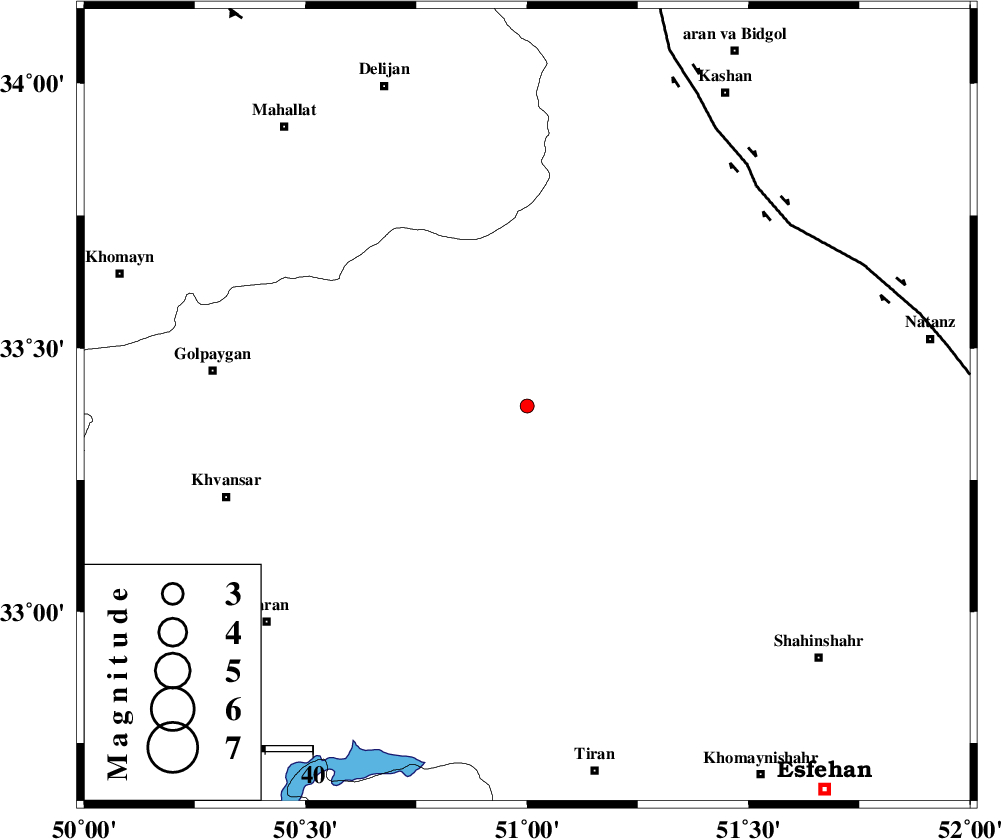
| Location | Lat:33.39 Lon: 51 |
| Region | Esfahan Province, 67 km East of Golpayegan |
Nearest Cities |
|
| 17 km West of Meymeh, Esfahan Province | |
| 17 km West of Vazvan, Esfahan Province | |
| 18 km East of Hasan robat, Esfahan Province | |
| 19 km North West of Vandadeh, Esfahan Province | |
| 30 km South West of Joshqan qali, Esfahan Province | |
| Depth | 39 km |
| Agency | |
Faults within 150 km: |
|
| KASHAN_F (Length: 44 km) , Distance to epicenter: 67 km | |
| ZEFREH_F (Length: 124 km) , Distance to epicenter: 67 km | |
| TAFRESH_F (Length: 117 km) , Distance to epicenter: 101 km | |
| Number of Phases | 6 |
| RMS | 0 |
| Number of Stations | 3 |
| Error in Latitude | >2.3 km |
| Error in Longitude | 2 km |
| Error in Depth | 8.8 km |
Download waveform in seisan format
to download seisan software Click here
to access information about IIEES stations Click here
Amplitude | ||||||||
| UID | Agency | Station | Component | Amplitude | Period | Arrival Time | Proccessing Time | Signal Clip |
| 90982 | IIEES | KHMZ | N | 40.6 | 0.11 | 2013-11-12 09:57:27 | 2013-11-12 10:21:00 | n |
| 90983 | IIEES | ASAO | N | 18.9 | 0.31 | 2013-11-12 09:57:39 | 2013-11-12 10:21:00 | n |
Phase | ||||||||||||
| Agency | Station | Component | Phase Type | Phase Quality | First Motion | Observed Arrival Time | Time Residual | Loc. Flag | Input Weight | Distance | Azimuth | |
| IIEES | KHMZ | Z | Pg | E | 2013-11-12 09:57:11 | -0.01 | y | 104 | 292 | |||
| IIEES | KHMZ | N | Sg | E | 2013-11-12 09:57:24 | 0.01 | y | 104 | 292 | |||
| IIEES | GHVR | Z | Pg | E | 2013-11-12 09:57:14 | -0.04 | y | 123 | 10 | |||
| IIEES | GHVR | E | Sg | E | 2013-11-12 09:57:29 | 0.02 | y | 123 | 10 | |||
| IIEES | ASAO | Z | Pg | E | 2013-11-12 09:57:19 | 0.05 | y | 157 | 325 | |||
| IIEES | ASAO | E | Sg | E | 2013-11-12 09:57:38 | -0.03 | y | 157 | 325 | |||