
Magnitude |
2.5 |
| Date & Time (UTC) | 2013-11-12 23:00:04.0 |
| Date & Time (Local) | 1392/8/22 02:30:04.0 |
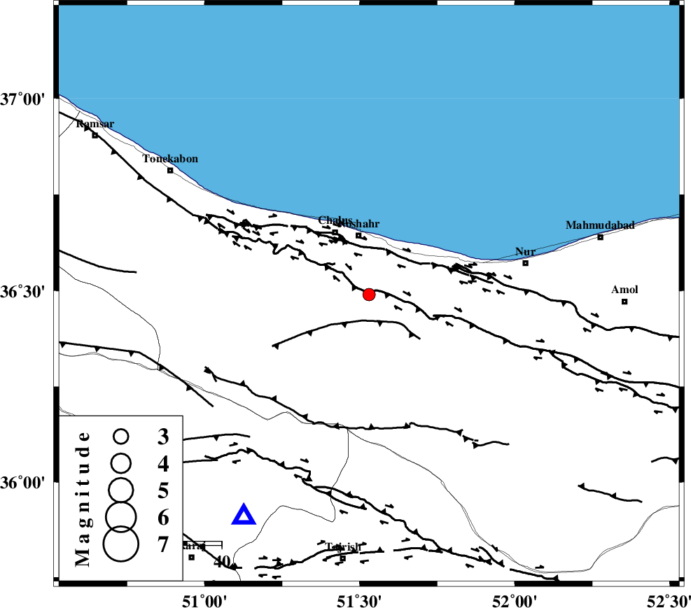
| Location | Lat:36.49 Lon: 51.53 |
| Region | Mazandaran Province, 18 km South of Nowshahr |
Nearest Cities |
|
| 12 km North of Pul, Mazandaran Province | |
| 17 km South of Nowshahr, Mazandaran Province | |
| 19 km West of Andarud, Mazandaran Province | |
| 21 km South East of Chalus, Mazandaran Province | |
| 21 km North West of Kujur, Mazandaran Province | |
| Depth | 14 km |
| Agency | |
Faults within 150 km: |
|
| N_ALBORZ_F (Length: 360 km) , Distance to epicenter: 2 km | |
| KOJOOR (Length: 75 km) , Distance to epicenter: 11 km | |
| KHAZAR_F (Length: 523 km) , Distance to epicenter: 12 km | |
| Number of Phases | 6 |
| RMS | 0.1 |
| Number of Stations | 5 |
| Error in Latitude | >2.7 km |
| Error in Longitude | 2.3 km |
| Error in Depth | 4 km |
Download waveform in seisan format
to download seisan software Click here
to access information about IIEES stations Click here
Amplitude | ||||||||
| UID | Agency | Station | Component | Amplitude | Period | Arrival Time | Proccessing Time | Signal Clip |
| 90987 | IIEES | CHTH | N | 119.2 | 0.2 | 2013-11-12 23:00:26 | 2013-11-13 03:19:00 | n |
| 90988 | IIEES | THKV | E | 330.5 | 0.68 | 2013-11-12 23:00:31 | 2013-11-13 03:19:00 | n |
| 90989 | IIEES | ZNJK | N | 23.4 | 0.4 | 2013-11-12 23:01:20 | 2013-11-13 03:19:00 | n |
Phase | ||||||||||||
| Agency | Station | Component | Phase Type | Phase Quality | First Motion | Observed Arrival Time | Time Residual | Loc. Flag | Input Weight | Distance | Azimuth | |
| IIEES | CHTH | Z | Pg | E | 2013-11-12 23:00:16 | -0.04 | y | 73.6 | 209 | |||
| IIEES | THKV | Z | Pg | E | 2013-11-12 23:00:18 | 0.12 | y | 86 | 223 | |||
| IIEES | THKV | E | Sg | E | 2013-11-12 23:00:29 | -0.08 | y | 86 | 223 | |||
| IIEES | DAMV | Z | Pg | E | 2013-11-12 23:00:21 | -0.06 | y | 103 | 157 | |||
| IIEES | GHVR | Z | Pn | E | 2013-11-12 23:00:39 | 0 | y | 224 | 187 | |||
| IIEES | GHVR | N | Sg | E | 2013-11-12 23:01:07 | 0.06 | y | 224 | 187 | |||