
Magnitude |
3.5 |
| Date & Time (UTC) | 2013-11-14 12:23:00.7 |
| Date & Time (Local) | 1392/8/23 15:53:00.7 |
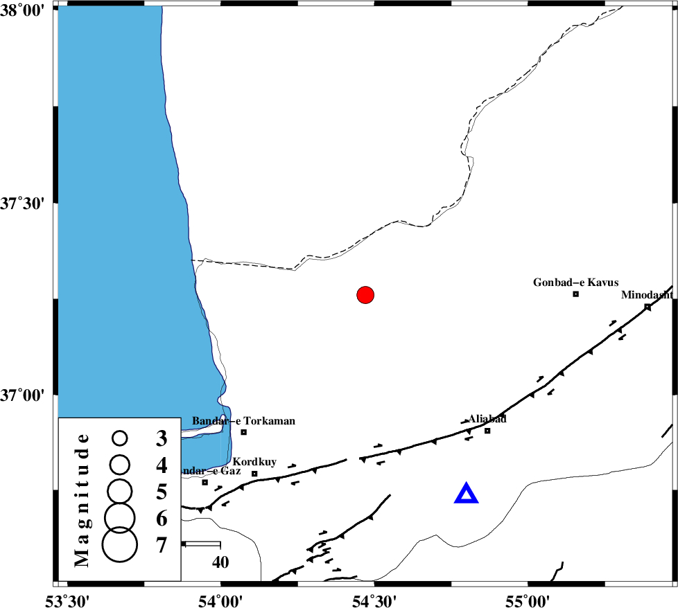
| Location | Lat:37.26 Lon: 54.47 |
| Region | Golestan Province, 28 km North of Aq Qaleh |
Nearest Cities |
|
| 28 km North of Aq Qaleh, Golestan Province | |
| 28 km North of Qanqarmeh, Golestan Province | |
| 31 km North West of Gariduji, Golestan Province | |
| 31 km South West of Enchehborun, Golestan Province | |
| 33 km North West of Nodeh malek, Golestan Province | |
| Depth | 15 km |
| Agency | |
Faults within 150 km: |
|
| KHAZAR_F (Length: 523 km) , Distance to epicenter: 45 km | |
| N_ALBORZ_F (Length: 360 km) , Distance to epicenter: 72 km | |
| SHAVAR_F (Length: 87 km) , Distance to epicenter: 77 km | |
| Number of Phases | 6 |
| RMS | 0.3 |
| Number of Stations | 7 |
| Error in Latitude | >7 km |
| Error in Longitude | 2.4 km |
| Error in Depth | 0 km |
Download waveform in seisan format
to download seisan software Click here
to access information about IIEES stations Click here
Amplitude | ||||||||
| UID | Agency | Station | Component | Amplitude | Period | Arrival Time | Proccessing Time | Signal Clip |
| 90995 | IIEES | DAMV | E | 207.7 | 0.44 | 2013-11-14 12:24:31 | 2013-11-14 12:49:00 | n |
Phase | ||||||||||||
| Agency | Station | Component | Phase Type | Phase Quality | First Motion | Observed Arrival Time | Time Residual | Loc. Flag | Input Weight | Distance | Azimuth | |
| IIEES | BJRD | E | Pn | E | 2013-11-14 12:23:41 | 0.05 | y | 265 | 78 | |||
| IIEES | CHTH | Z | Pn | E | 2013-11-14 12:23:50 | 0.39 | y | 334 | 244 | |||
| IIEES | THKV | Z | Pn | E | 2013-11-14 12:23:52 | 0.29 | y | 354 | 246 | |||
| IIEES | GHVR | Z | Pn | E | 2013-11-14 12:24:00 | -0.13 | y | 424 | 224 | |||
| IIEES | ZNJK | Z | Pn | E | 2013-11-14 12:24:12 | -0.65 | y | 519 | 264 | |||
| IIEES | YZKH | Z | Pn | E | 2013-11-14 12:24:15 | -0.2 | y | 540 | 179 | |||