
Magnitude |
2.9 |
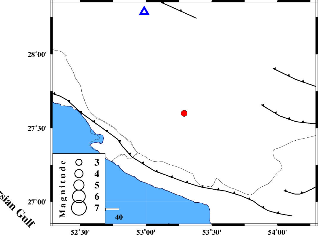
| Date & Time (UTC) | 2013-11-21 14:51:08.0 |
| Date & Time (Local) | 1392/8/30 18:21:08.0 |
| Location | Lat:27.6 Lon: 53.29 |
| Region | Fars Province, 32 km North-East of Lamerd |
Nearest Cities |
|
| 23 km North West of Fedagh, Fars Province | |
| 30 km North West of Beyram, Fars Province | |
| 32 km North East of Lamerd, Fars Province | |
| 32 km East of Alamarvdasht, Fars Province | |
| 33 km South West of Khonj, Fars Province | |
| Depth | 14 km |
| Agency | |
Faults within 150 km: |
|
| MFF3 (Length: 292 km) , Distance to epicenter: 49 km | |
| LAR_F (Length: 99 km) , Distance to epicenter: 58 km | |
| QIR_F (Length: 130 km) , Distance to epicenter: 72 km | |
| Number of Phases | 4 |
| RMS | 0.1 |
| Number of Stations | 4 |
| Error in Latitude | >4.8 km |
| Error in Longitude | 1.4 km |
| Error in Depth | 0 km |
Download waveform in seisan format
to download seisan software Click here
to access information about IIEES stations Click here
Amplitude | ||||||||
| UID | Agency | Station | Component | Amplitude | Period | Arrival Time | Proccessing Time | Signal Clip |
| 91029 | IIEES | AHRM | N | 80 | 0.52 | 2013-11-21 14:52:35 | 2013-11-21 03:27:00 | n |
| 91030 | IIEES | KRBR | E | 19.1 | 0.4 | 2013-11-21 14:53:01 | 2013-11-21 03:27:00 | n |
Phase | ||||||||||||
| Agency | Station | Component | Phase Type | Phase Quality | First Motion | Observed Arrival Time | Time Residual | Loc. Flag | Input Weight | Distance | Azimuth | |
| IIEES | AHRM | N | Pn | E | 2013-11-21 14:51:45 | -0.03 | y | 241 | 306 | |||
| IIEES | BNDS | Z | Pn | E | 2013-11-21 14:51:51 | 0.06 | y | 286 | 94 | |||
| IIEES | KRBR | Z | Pn | E | 2013-11-21 14:52:09 | -0.19 | y | 430 | 51 | |||
| IIEES | YZKH | Z | Pn | E | 2013-11-21 14:52:24 | 0.19 | y | 546 | 13 | |||