
Magnitude |
5.4 |
| Date & Time (UTC) | 2013-11-22 06:51:25.7 |
| Date & Time (Local) | 1392/9/1 10:21:25.7 |
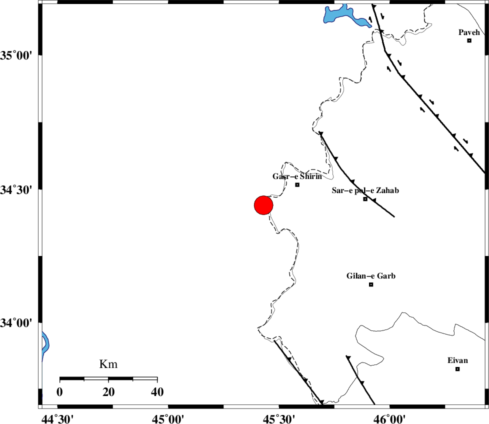
| Location | Lat:34.44 Lon: 45.43 |
| Region | Iraq, 16 km West of Qasr-E-Shirin |
Nearest Cities |
|
| 6 km North of Khosravi, Kermanshah Province | |
| 15 km West of Seyyed sohrab, Kermanshah Province | |
| 16 km West of Qasr-E-Shirin, Kermanshah Province | |
| 25 km South West of Aqabarar, Kermanshah Province | |
| 32 km West of Qareh belagh, Kermanshah Province | |
| Depth | 14 km |
| Agency | |
Faults within 150 km: |
|
| MFF8 (Length: 48 km) , Distance to epicenter: 35 km | |
| ZFF4 (Length: 128 km) , Distance to epicenter: 57 km | |
| MFF7 (Length: 99 km) , Distance to epicenter: 71 km | |
| Number of Phases | 7 |
| RMS | 0.1 |
| Number of Stations | 6 |
| Error in Latitude | >3.1 km |
| Error in Longitude | 14.7 km |
| Error in Depth | 17.7 km |
Download waveform in seisan format
to download seisan software Click here
to access information about IIEES stations Click here
Amplitude | ||||||||
| UID | Agency | Station | Component | Amplitude | Period | Arrival Time | Proccessing Time | Signal Clip |
| 91033 | IIEES | SHGR | E | 8734.8 | 0.52 | 2013-11-22 06:53:32 | 2013-11-22 10:35:00 | n |
| 91034 | IIEES | SHGR | N | 10846.8 | 0.56 | 2013-11-22 06:53:45 | 2013-11-22 10:35:00 | n |
| 91035 | IIEES | KHMZ | E | 2284.6 | 0.56 | 2013-11-22 06:53:39 | 2013-11-22 10:35:00 | n |
Phase | ||||||||||||
| Agency | Station | Component | Phase Type | Phase Quality | First Motion | Observed Arrival Time | Time Residual | Loc. Flag | Input Weight | Distance | Azimuth | |
| IIEES | ZNJK | Z | P | E | 2013-11-22 06:52:21 | 0.04 | y | 385 | 49 | |||
| IIEES | SHGR | Z | P | E | 2013-11-22 06:52:23 | -0.01 | y | 407 | 129 | |||
| IIEES | ASAO | Z | P | E | 2013-11-22 06:52:26 | 0.14 | y | 422 | 87 | |||
| IIEES | KHMZ | Z | Pn | E | 2013-11-22 06:52:26 | -0.05 | y | 426 | 99 | |||
| IIEES | KHMZ | N | S | E | 2013-11-22 06:53:10 | 0 | y | 426 | 99 | |||
| IIEES | GHVR | Z | P | E | 2013-11-22 06:52:39 | 0.03 | y | 535 | 88 | |||
| IIEES | CHTH | Z | P | E | 2013-11-22 06:52:41 | -0.18 | y | 544 | 71 | |||