
Magnitude |
3.9 |
| Date & Time (UTC) | 2013-11-22 10:10:01.1 |
| Date & Time (Local) | 1392/9/1 13:40:01.1 |
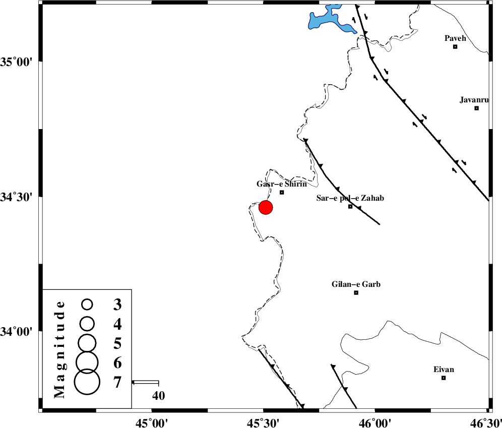
| Location | Lat:34.46 Lon: 45.51 |
| Region | Kermanshah Province, 10 km Qasr-E-Shirin |
Nearest Cities |
|
| 7 km North of Khosravi, Kermanshah Province | |
| 8 km North of Seyyed sohrab, Kermanshah Province | |
| 9 km of Qasr-E-Shirin, Kermanshah Province | |
| 17 km West of Aqabarar, Kermanshah Province | |
| 25 km West of Qareh belagh, Kermanshah Province | |
| Depth | 18 km |
| Agency | |
Faults within 150 km: |
|
| MFF8 (Length: 48 km) , Distance to epicenter: 28 km | |
| ZFF4 (Length: 128 km) , Distance to epicenter: 59 km | |
| MFF7 (Length: 99 km) , Distance to epicenter: 70 km | |
| Number of Phases | 7 |
| RMS | 0.1 |
| Number of Stations | 6 |
| Error in Latitude | >2.8 km |
| Error in Longitude | 14.1 km |
| Error in Depth | 13 km |
Download waveform in seisan format
to download seisan software Click here
to access information about IIEES stations Click here
Amplitude | ||||||||
| UID | Agency | Station | Component | Amplitude | Period | Arrival Time | Proccessing Time | Signal Clip |
| 91036 | IIEES | SHGR | N | 206.9 | 0.28 | 2013-11-22 10:11:44 | 2013-11-22 10:35:00 | n |
Phase | ||||||||||||
| Agency | Station | Component | Phase Type | Phase Quality | First Motion | Observed Arrival Time | Time Residual | Loc. Flag | Input Weight | Distance | Azimuth | |
| IIEES | ZNJK | Z | Pn | E | 2013-11-22 10:10:55 | 0.02 | y | 378 | 49 | |||
| IIEES | ZNJK | N | Sg | E | 2013-11-22 10:11:47 | 0.04 | y | 378 | 49 | |||
| IIEES | SHGR | Z | Pn | E | 2013-11-22 10:10:58 | 0.1 | y | 402 | 129 | |||
| IIEES | KHMZ | Z | P | E | 2013-11-22 10:11:00 | -0.01 | y | 419 | 100 | |||
| IIEES | GHVR | Z | Pn | E | 2013-11-22 10:11:13 | -0.06 | y | 527 | 88 | |||
| IIEES | CHTH | Z | Pn | E | 2013-11-22 10:11:15 | -0.06 | y | 536 | 71 | |||
| IIEES | YZKH | Z | Pn | E | 2013-11-22 10:11:57 | -0.16 | y | 875 | 103 | |||