
Magnitude |
3.9 |
| Date & Time (UTC) | 2013-11-22 19:24:03.9 |
| Date & Time (Local) | 1392/9/1 22:54:03.9 |
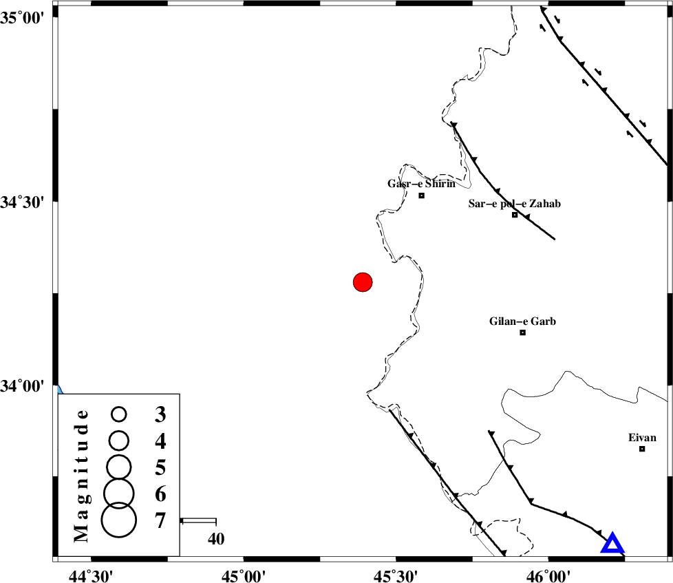
| Location | Lat:34.28 Lon: 45.39 |
| Region | Iraq, 32 km South-West of Qasr-E-Shirin |
Nearest Cities |
|
| 16 km South of Khosravi, Kermanshah Province | |
| 26 km South West of Seyyed sohrab, Kermanshah Province | |
| 32 km South West of Qasr-E-Shirin, Kermanshah Province | |
| 39 km South West of Aqabarar, Kermanshah Province | |
| 42 km South West of Qareh belagh, Kermanshah Province | |
| Depth | 15 km |
| Agency | |
Faults within 150 km: |
|
| ZFF4 (Length: 128 km) , Distance to epicenter: 39 km | |
| MFF8 (Length: 48 km) , Distance to epicenter: 49 km | |
| MFF7 (Length: 99 km) , Distance to epicenter: 59 km | |
| Number of Phases | 7 |
| RMS | 0.3 |
| Number of Stations | 7 |
| Error in Latitude | >5.3 km |
| Error in Longitude | 7 km |
| Error in Depth | 0 km |
Download waveform in seisan format
to download seisan software Click here
to access information about IIEES stations Click here
Amplitude | ||||||||
| UID | Agency | Station | Component | Amplitude | Period | Arrival Time | Proccessing Time | Signal Clip |
| 91041 | IIEES | SHGR | E | 201.1 | 0.72 | 2013-11-22 19:26:11 | 2013-11-22 07:50:00 | n |
Phase | ||||||||||||
| Agency | Station | Component | Phase Type | Phase Quality | First Motion | Observed Arrival Time | Time Residual | Loc. Flag | Input Weight | Distance | Azimuth | |
| IIEES | SHGR | Z | Pn | E | 2013-11-22 19:25:00 | -0.19 | y | 399 | 126 | |||
| IIEES | ZNJK | Z | Pn | E | 2013-11-22 19:25:01 | -0.22 | y | 400 | 47 | |||
| IIEES | KHMZ | Z | Pn | E | 2013-11-22 19:25:05 | 0.47 | y | 426 | 97 | |||
| IIEES | ASAO | Z | Pn | E | 2013-11-22 19:25:04 | -0.25 | y | 427 | 85 | |||
| IIEES | GHVR | Z | Pn | E | 2013-11-22 19:25:18 | 0.27 | y | 539 | 86 | |||
| IIEES | GRMI | Z | Pn | E | 2013-11-22 19:25:20 | 0.23 | y | 551 | 23 | |||
| IIEES | CHTH | Z | Pn | E | 2013-11-22 19:25:20 | -0.23 | y | 553 | 69 | |||