
Magnitude |
4.4 |
| Date & Time (UTC) | 2013-11-22 21:02:32.9 |
| Date & Time (Local) | 1392/9/2 00:32:32.9 |
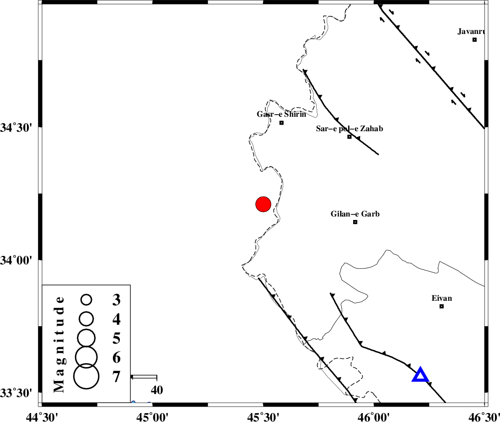
| Location | Lat:34.21 Lon: 45.5 |
| Region | Iraq, 35 km South of Qasr-E-Shirin |
Nearest Cities |
|
| 21 km South of Khosravi, Kermanshah Province | |
| 27 km South of Seyyed sohrab, Kermanshah Province | |
| 35 km South of Qasr-E-Shirin, Kermanshah Province | |
| 35 km South West of Chub baghan, Kermanshah Province | |
| 39 km North West of Gilan-E-Gharb, Kermanshah Province | |
| Depth | 15 km |
| Agency | |
Faults within 150 km: |
|
| ZFF4 (Length: 128 km) , Distance to epicenter: 31 km | |
| MFF8 (Length: 48 km) , Distance to epicenter: 46 km | |
| MFF7 (Length: 99 km) , Distance to epicenter: 46 km | |
| Number of Phases | 7 |
| RMS | 0.1 |
| Number of Stations | 7 |
| Error in Latitude | >3 km |
| Error in Longitude | 3.8 km |
| Error in Depth | 0 km |
Download waveform in seisan format
to download seisan software Click here
to access information about IIEES stations Click here
Amplitude | ||||||||
| UID | Agency | Station | Component | Amplitude | Period | Arrival Time | Proccessing Time | Signal Clip |
| 91044 | IIEES | SHGR | E | 728.5 | 0.64 | 2013-11-22 21:04:38 | 2013-11-22 09:25:00 | n |
Phase | ||||||||||||
| Agency | Station | Component | Phase Type | Phase Quality | First Motion | Observed Arrival Time | Time Residual | Loc. Flag | Input Weight | Distance | Azimuth | |
| IIEES | SHGR | Z | Pn | E | 2013-11-22 21:03:28 | 0.05 | y | 386 | 126 | |||
| IIEES | ZNJK | Z | Pn | E | 2013-11-22 21:03:30 | -0.02 | y | 398 | 46 | |||
| IIEES | KHMZ | Z | Pn | E | 2013-11-22 21:03:32 | -0.23 | y | 416 | 96 | |||
| IIEES | ASAO | Z | Pn | E | 2013-11-22 21:03:32 | 0.02 | y | 418 | 84 | |||
| IIEES | GHVR | Z | Pn | E | 2013-11-22 21:03:46 | 0.2 | y | 529 | 85 | |||
| IIEES | CHTH | Z | Pn | E | 2013-11-22 21:03:48 | 0.03 | y | 547 | 68 | |||
| IIEES | GRMI | Z | Pn | E | 2013-11-22 21:03:49 | -0.01 | y | 554 | 22 | |||