
Magnitude |
3.2 |
| Date & Time (UTC) | 2013-11-22 23:43:45.7 |
| Date & Time (Local) | 1392/9/2 03:13:45.7 |
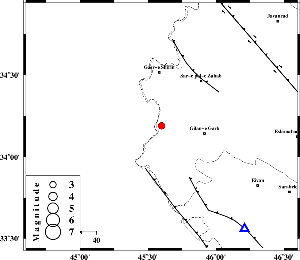
| Location | Lat:34.19 Lon: 45.6 |
| Region | Kermanshah Province, 36 km South of Qasr-E-Shirin |
Nearest Cities |
|
| 26 km South East of Khosravi, Kermanshah Province | |
| 28 km South West of Chub baghan, Kermanshah Province | |
| 28 km South of Seyyed sohrab, Kermanshah Province | |
| 29 km North West of Gilan-E-Gharb, Kermanshah Province | |
| 35 km North of Sumar, Kermanshah Province | |
| Depth | 15 km |
| Agency | |
Faults within 150 km: |
|
| ZFF4 (Length: 128 km) , Distance to epicenter: 31 km | |
| MFF7 (Length: 99 km) , Distance to epicenter: 40 km | |
| MFF8 (Length: 48 km) , Distance to epicenter: 42 km | |
| Number of Phases | 4 |
| RMS | 0 |
| Number of Stations | 5 |
| Error in Latitude | >8.9 km |
| Error in Longitude | 3.2 km |
| Error in Depth | 0 km |
Download waveform in seisan format
to download seisan software Click here
to access information about IIEES stations Click here
Amplitude | ||||||||
| UID | Agency | Station | Component | Amplitude | Period | Arrival Time | Proccessing Time | Signal Clip |
| 91048 | IIEES | SHGR | E | 46.6 | 0.52 | 2013-11-22 23:45:55 | 2013-11-23 12:03:00 | n |
Phase | ||||||||||||
| Agency | Station | Component | Phase Type | Phase Quality | First Motion | Observed Arrival Time | Time Residual | Loc. Flag | Input Weight | Distance | Azimuth | |
| IIEES | ZNJK | Z | Pn | E | 2013-11-22 23:44:42 | 0.02 | y | 393 | 45 | |||
| IIEES | KHMZ | Z | Pn | E | 2013-11-22 23:44:44 | 0.02 | y | 407 | 96 | |||
| IIEES | ASAO | Z | Pn | E | 2013-11-22 23:44:44 | -0.02 | y | 409 | 83 | |||
| IIEES | GRMI | Z | Pn | E | 2013-11-22 23:45:02 | -0.01 | y | 552 | 21 | |||