
Magnitude |
3.7 |
| Date & Time (UTC) | 2013-11-23 14:22:41.8 |
| Date & Time (Local) | 1392/9/2 17:52:41.8 |
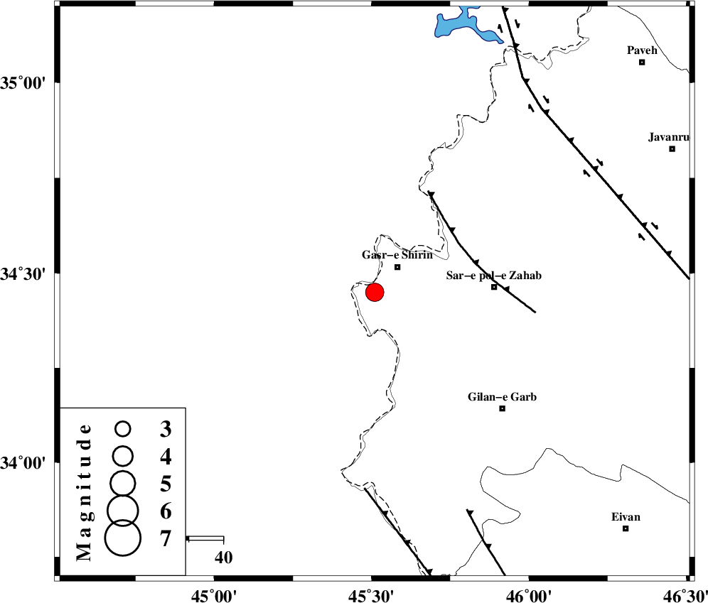
| Location | Lat:34.45 Lon: 45.51 |
| Region | Kermanshah Province, 10 km Qasr-E-Shirin |
Nearest Cities |
|
| 6 km North of Khosravi, Kermanshah Province | |
| 8 km North of Seyyed sohrab, Kermanshah Province | |
| 10 km of Qasr-E-Shirin, Kermanshah Province | |
| 18 km West of Aqabarar, Kermanshah Province | |
| 25 km West of Qareh belagh, Kermanshah Province | |
| Depth | 15 km |
| Agency | |
Faults within 150 km: |
|
| MFF8 (Length: 48 km) , Distance to epicenter: 28 km | |
| ZFF4 (Length: 128 km) , Distance to epicenter: 58 km | |
| MFF7 (Length: 99 km) , Distance to epicenter: 69 km | |
| Number of Phases | 4 |
| RMS | 0.1 |
| Number of Stations | 4 |
| Error in Latitude | >3.2 km |
| Error in Longitude | 4.9 km |
| Error in Depth | 0 km |
Download waveform in seisan format
to download seisan software Click here
to access information about IIEES stations Click here
Amplitude | ||||||||
| UID | Agency | Station | Component | Amplitude | Period | Arrival Time | Proccessing Time | Signal Clip |
| 91054 | IIEES | SHGR | E | 131.1 | 0.48 | 2013-11-23 14:24:46 | 2013-11-23 02:51:00 | n |
Phase | ||||||||||||
| Agency | Station | Component | Phase Type | Phase Quality | First Motion | Observed Arrival Time | Time Residual | Loc. Flag | Input Weight | Distance | Azimuth | |
| IIEES | ZNJK | Z | Pn | E | 2013-11-23 14:23:36 | 0.12 | y | 379 | 48 | |||
| IIEES | SHGR | Z | Pn | E | 2013-11-23 14:23:39 | 0.06 | y | 401 | 129 | |||
| IIEES | KHMZ | Z | Pn | E | 2013-11-23 14:23:41 | -0.11 | y | 418 | 100 | |||
| IIEES | GRMI | Z | Pn | E | 2013-11-23 14:23:55 | -0.09 | y | 529 | 23 | |||