
Magnitude |
5.3 |
| Date & Time (UTC) | 2013-11-24 18:05:43.1 |
| Date & Time (Local) | 1392/9/3 21:35:43.1 |
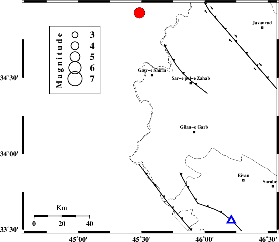
| Location | Lat:34.24 Lon: 45.57 |
| Region | Iraq, 30 km South of Qasr-E-Shirin |
Nearest Cities |
|
| 20 km South of Khosravi, Kermanshah Province | |
| 23 km South of Seyyed sohrab, Kermanshah Province | |
| 28 km West of Chub baghan, Kermanshah Province | |
| 31 km South of Qasr-E-Shirin, Kermanshah Province | |
| 33 km South West of Qareh belagh, Kermanshah Province | |
| Depth | 17 km |
| Agency | |
Faults within 150 km: |
|
| ZFF4 (Length: 128 km) , Distance to epicenter: 35 km | |
| MFF8 (Length: 48 km) , Distance to epicenter: 40 km | |
| MFF7 (Length: 99 km) , Distance to epicenter: 46 km | |
| Number of Phases | 7 |
| RMS | 0.1 |
| Number of Stations | 6 |
| Error in Latitude | >3 km |
| Error in Longitude | 5.3 km |
| Error in Depth | 9.3 km |
Download waveform in seisan format
to download seisan software Click here
to access information about IIEES stations Click here
Amplitude | ||||||||
| UID | Agency | Station | Component | Amplitude | Period | Arrival Time | Proccessing Time | Signal Clip |
| 91065 | IIEES | SHGR | N | 6448.4 | 0.48 | 2013-11-24 18:07:49 | 2013-11-24 06:43:00 | n |
| 91066 | IIEES | SHGR | E | 6426.8 | 0.6 | 2013-11-24 18:07:57 | 2013-11-24 06:43:00 | n |
Phase | ||||||||||||
| Agency | Station | Component | Phase Type | Phase Quality | First Motion | Observed Arrival Time | Time Residual | Loc. Flag | Input Weight | Distance | Azimuth | |
| IIEES | SHGR | Z | Pn | E | 2013-11-24 18:06:38 | 0.07 | y | 383 | 127 | |||
| IIEES | ZNJK | Z | Pn | E | 2013-11-24 18:06:39 | 0.1 | y | 390 | 45 | |||
| IIEES | ZNJK | E | Sg | E | 2013-11-24 18:07:32 | 0 | y | 390 | 45 | |||
| IIEES | KHMZ | Z | Pn | E | 2013-11-24 18:06:41 | -0.07 | y | 410 | 97 | |||
| IIEES | GHVR | Z | Pn | E | 2013-11-24 18:06:55 | -0.13 | y | 522 | 86 | |||
| IIEES | CHTH | Z | Pn | E | 2013-11-24 18:06:57 | 0.04 | y | 539 | 68 | |||
| IIEES | MAKU | Z | Pn | E | 2013-11-24 18:07:01 | -0.05 | y | 573 | 352 | |||