
Magnitude |
4.6 |
| Date & Time (UTC) | 2013-11-28 15:56:45.6 |
| Date & Time (Local) | 1392/9/7 19:26:45.6 |
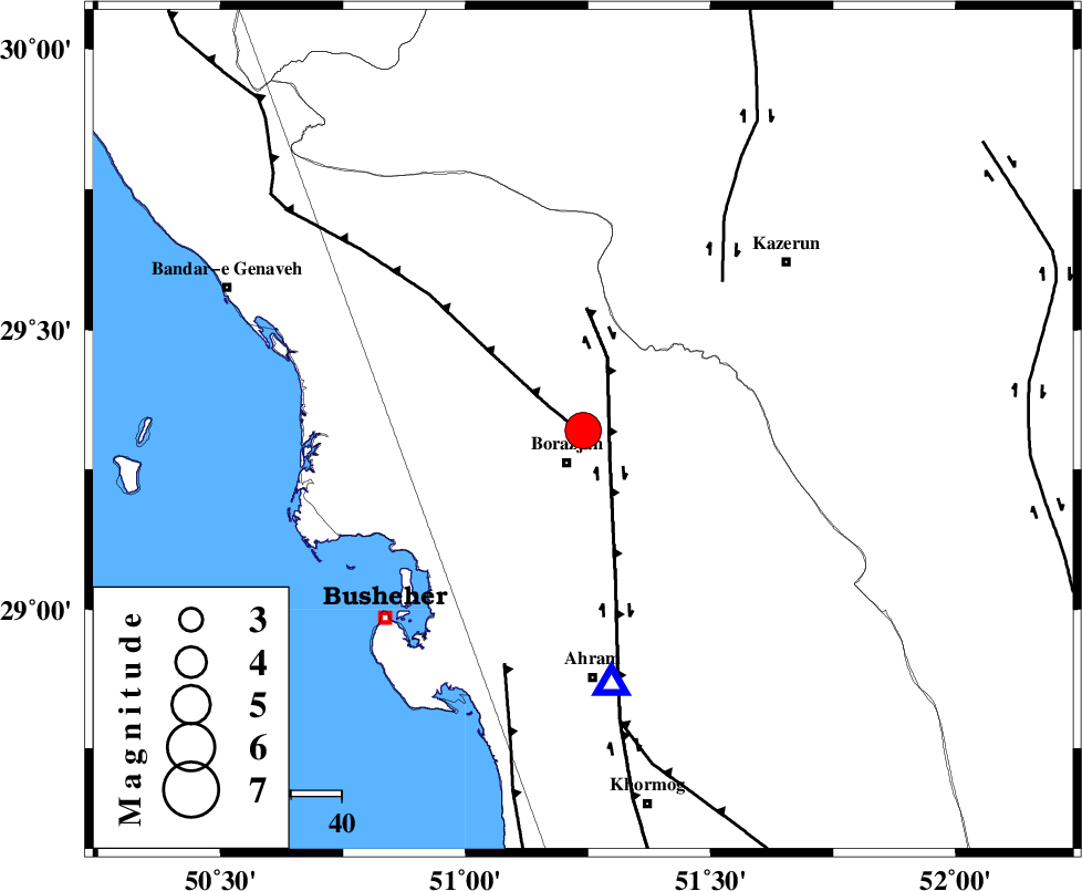
| Location | Lat:29.32 Lon: 51.24 |
| Region | Bushehr Province, 7 km Borazjan |
Nearest Cities |
|
| 7 km North of Borazjan, Bushehr Province | |
| 8 km of Nazar aqa, Bushehr Province | |
| 13 km East of Saedabad, Bushehr Province | |
| 14 km South of Dalki, Bushehr Province | |
| 15 km North of Sarkareh, Bushehr Province | |
| Depth | 15 km |
| Agency | |
Faults within 150 km: |
|
| ZFF3 (Length: 125 km) , Distance to epicenter: 1 km | |
| BORAZJAN_F (Length: 168 km) , Distance to epicenter: 8 km | |
| KAZERUN_F (Length: 96 km) , Distance to epicenter: 40 km | |
| Number of Phases | 4 |
| RMS | 0.1 |
| Number of Stations | 4 |
| Error in Latitude | >13.5 km |
| Error in Longitude | 2.1 km |
| Error in Depth | 0 km |
Download waveform in seisan format
to download seisan software Click here
to access information about IIEES stations Click here
Amplitude | ||||||||
| UID | Agency | Station | Component | Amplitude | Period | Arrival Time | Proccessing Time | Signal Clip |
| 91098 | IIEES | SHGR | N | 1223.7 | 0.44 | 2013-11-28 15:58:26 | 2013-11-28 04:54:00 | n |
| 91099 | IIEES | SHGR | E | 1365.7 | 0.64 | 2013-11-28 15:58:26 | 2013-11-28 04:54:00 | n |
Phase | ||||||||||||
| Agency | Station | Component | Phase Type | Phase Quality | First Motion | Observed Arrival Time | Time Residual | Loc. Flag | Input Weight | Distance | Azimuth | |
| IIEES | SHGR | Z | Pn | E | 2013-11-28 15:57:41 | 0.01 | y | 388 | 324 | |||
| IIEES | YZKH | Z | Pn | E | 2013-11-28 15:57:51 | -0.01 | y | 468 | 42 | |||
| IIEES | GHVR | Z | Pn | E | 2013-11-28 15:58:04 | 0.08 | y | 573 | 0 | |||
| IIEES | ASAO | Z | Pn | E | 2013-11-28 15:58:06 | -0.09 | y | 591 | 349 | |||