
Magnitude |
3.6 |
| Date & Time (UTC) | 2013-12-01 18:45:55.2 |
| Date & Time (Local) | 1392/9/10 22:15:55.2 |
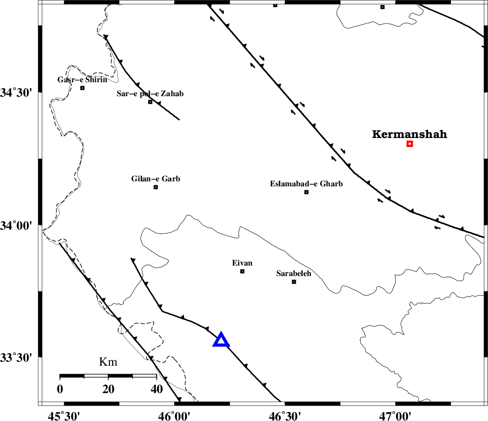
| Location | Lat:34.08 Lon: 46.4 |
| Region | Kermanshah Province, 19 km West of Eslam Abad-E-Gharb |
Nearest Cities |
|
| 12 km North East of Sarmast, Kermanshah Province | |
| 12 km South of Khosroabad, Kermanshah Province | |
| 19 km South East of Telesm, Kermanshah Province | |
| 19 km West of Eslam Abad-E-Gharb, Kermanshah Province | |
| 26 km North East of Zarneh, Ilam Province | |
| Depth | 18 km |
| Agency | |
Faults within 150 km: |
|
| HZF4 (Length: 492 km) , Distance to epicenter: 37 km | |
| MFF8 (Length: 48 km) , Distance to epicenter: 49 km | |
| MFF7 (Length: 99 km) , Distance to epicenter: 58 km | |
| Number of Phases | 6 |
| RMS | 0.1 |
| Number of Stations | 4 |
| Error in Latitude | >1.3 km |
| Error in Longitude | 9.8 km |
| Error in Depth | 6.8 km |
Download waveform in seisan format
to download seisan software Click here
to access information about IIEES stations Click here
Amplitude | ||||||||
| UID | Agency | Station | Component | Amplitude | Period | Arrival Time | Proccessing Time | Signal Clip |
| 91130 | IIEES | SHGR | E | 184.1 | 0.48 | 2013-12-01 18:47:29 | 2013-12-01 07:29:00 | n |
| 91131 | IIEES | SHGR | N | 195.8 | 0.48 | 2013-12-01 18:47:35 | 2013-12-01 07:29:00 | n |
Phase | ||||||||||||
| Agency | Station | Component | Phase Type | Phase Quality | First Motion | Observed Arrival Time | Time Residual | Loc. Flag | Input Weight | Distance | Azimuth | |
| IIEES | SHGR | Z | Pn | E | 2013-12-01 18:46:41 | 0.06 | y | 313 | 134 | |||
| IIEES | SHGR | E | Sg | E | 2013-12-01 18:47:22 | 0.02 | y | 313 | 134 | |||
| IIEES | ASAO | Z | Pn | E | 2013-12-01 18:46:44 | -0.1 | y | 338 | 80 | |||
| IIEES | ZNJK | Z | Pn | E | 2013-12-01 18:46:46 | 0.02 | y | 355 | 35 | |||
| IIEES | ZNJK | E | Sg | E | 2013-12-01 18:47:34 | 0.05 | y | 355 | 35 | |||
| IIEES | GHVR | Z | P | E | 2013-12-01 18:46:58 | -0.06 | y | 448 | 83 | |||