
Magnitude |
3 |
| Date & Time (UTC) | 2013-12-07 23:42:18.5 |
| Date & Time (Local) | 1392/9/17 03:12:18.5 |
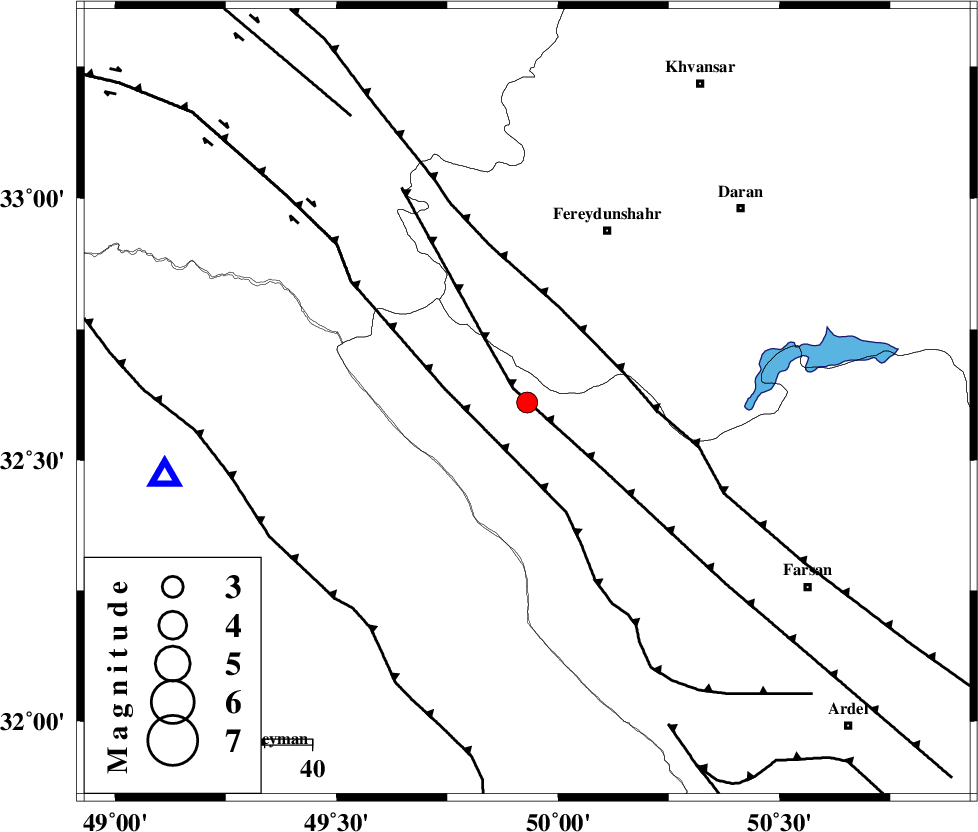
| Location | Lat:32.61 Lon: 49.93 |
| Region | Chaharmahal Bakhtiari Province, 24 km North-West of Chelgard |
Nearest Cities |
|
| 11 km of Durak, Chaharmahal Bakhtiari Province | |
| 24 km North West of Chelgard, Chaharmahal Bakhtiari Province | |
| 27 km South of Masir, Esfahan Province | |
| 31 km South West of Ghale? sorkh, Esfahan Province | |
| 33 km South West of Sibak, Esfahan Province | |
| Depth | 14 km |
| Agency | |
Faults within 150 km: |
|
| ARDAL_F (Length: 170 km) , Distance to epicenter: 4 km | |
| ZARDKUH_F (Length: 139 km) , Distance to epicenter: 18 km | |
| MAIN_ZAGROS_R_F (Length: 1106 km) , Distance to epicenter: 21 km | |
| Number of Phases | 4 |
| RMS | 0.1 |
| Number of Stations | 4 |
| Error in Latitude | >5.3 km |
| Error in Longitude | 7.1 km |
| Error in Depth | 4.8 km |
Download waveform in seisan format
to download seisan software Click here
to access information about IIEES stations Click here
Amplitude | ||||||||
| UID | Agency | Station | Component | Amplitude | Period | Arrival Time | Proccessing Time | Signal Clip |
| 91166 | IIEES | SHGR | N | 316.7 | 0.4 | 2013-12-07 23:42:56 | 2013-12-08 12:07:00 | n |
Phase | ||||||||||||
| Agency | Station | Component | Phase Type | Phase Quality | First Motion | Observed Arrival Time | Time Residual | Loc. Flag | Input Weight | Distance | Azimuth | |
| IIEES | SHGR | Z | Pg | E | 2013-12-07 23:42:38 | -0.02 | y | 120 | 243 | |||
| IIEES | KHMZ | Z | Pg | E | 2013-12-07 23:42:39 | -0.09 | y | 126 | 1 | |||
| IIEES | ASAO | Z | Pn | E | 2013-12-07 23:42:53 | 0.15 | y | 216 | 2 | |||
| IIEES | GHVR | Z | Pg | E | 2013-12-07 23:42:57 | -0.04 | y | 241 | 30 | |||