
Magnitude |
3.6 |
| Date & Time (UTC) | 2013-12-10 16:33:09.2 |
| Date & Time (Local) | 1392/9/19 20:03:09.2 |
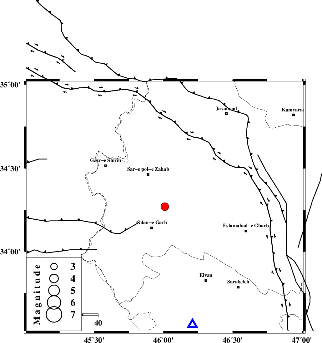
| Location | Lat:34.27 Lon: 46.01 |
| Region | Kermanshah Province, 16 km North of Gilan-E-Gharb |
Nearest Cities |
|
| 15 km East of Chub baghan, Kermanshah Province | |
| 15 km North of Sarkhor namdar abdi, Kermanshah Province | |
| 17 km North of Gilan-E-Gharb, Kermanshah Province | |
| 17 km South of Tarkveys, Kermanshah Province | |
| 20 km South of Rijab, Kermanshah Province | |
| Depth | 14 km |
| Agency | |
Faults within 150 km: |
|
| MFF8 (Length: 48 km) , Distance to epicenter: 14 km | |
| MFF7 (Length: 99 km) , Distance to epicenter: 48 km | |
| HZF4 (Length: 492 km) , Distance to epicenter: 50 km | |
| Number of Phases | 7 |
| RMS | 0.2 |
| Number of Stations | 5 |
| Error in Latitude | >4 km |
| Error in Longitude | 16.3 km |
| Error in Depth | 22.9 km |
Download waveform in seisan format
to download seisan software Click here
to access information about IIEES stations Click here
Amplitude | ||||||||
| UID | Agency | Station | Component | Amplitude | Period | Arrival Time | Proccessing Time | Signal Clip |
| 91179 | IIEES | KHMZ | N | 128.1 | 0.84 | 2013-12-10 16:34:55 | 2013-12-10 05:38:00 | n |
| 91180 | IIEES | GHVR | E | 59 | 0.64 | 2013-12-10 16:35:22 | 2013-12-10 05:38:00 | n |
Phase | ||||||||||||
| Agency | Station | Component | Phase Type | Phase Quality | First Motion | Observed Arrival Time | Time Residual | Loc. Flag | Input Weight | Distance | Azimuth | |
| IIEES | SHGR | Z | Pn | E | 2013-12-10 16:34:00 | 0.05 | y | 354 | 132 | |||
| IIEES | ZNJK | Z | Pn | E | 2013-12-10 16:34:01 | -0.14 | y | 361 | 42 | |||
| IIEES | KHMZ | Z | Pn | E | 2013-12-10 16:34:03 | 0.04 | y | 370 | 98 | |||
| IIEES | KHMZ | N | Sg | E | 2013-12-10 16:34:52 | -0.26 | y | 370 | 98 | |||
| IIEES | ASAO | Z | P | E | 2013-12-10 16:34:03 | 0.2 | y | 371 | 84 | |||
| IIEES | ASAO | N | Sg | E | 2013-12-10 16:34:53 | 0.24 | y | 371 | 84 | |||
| IIEES | GHVR | Z | Pn | E | 2013-12-10 16:34:16 | -0.16 | y | 483 | 86 | |||