
Magnitude |
3.2 |
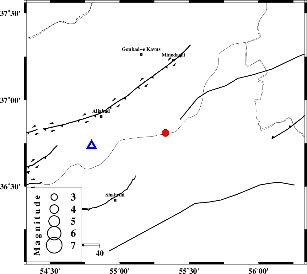
| Date & Time (UTC) | 2013-12-12 16:40:26.6 |
| Date & Time (Local) | 1392/9/21 20:10:26.6 |
| Location | Lat:36.81 Lon: 55.33 |
| Region | Golestan Province, 28 km South-East of Ramian |
Nearest Cities |
|
| 16 km North of Kalateh khanj, Semnan Province | |
| 18 km South of Farsian, Golestan Province | |
| 28 km North East of Qaleh-ye nokharqan, Semnan Province | |
| 28 km South East of Ramian, Golestan Province | |
| 30 km South West of Qale-ye qafeh, Golestan Province | |
| Depth | 15 km |
| Agency | |
Faults within 150 km: |
|
| SHAVAR_F (Length: 87 km) , Distance to epicenter: 11 km | |
| ROBATE_QARABIL_F (Length: 168 km) , Distance to epicenter: 13 km | |
| KHAZAR_F (Length: 523 km) , Distance to epicenter: 39 km | |
| Number of Phases | 3 |
| RMS | 0 |
| Number of Stations | 4 |
| Error in Latitude | >2.1 km |
| Error in Longitude | 2.1 km |
| Error in Depth | 0 km |
Download waveform in seisan format
to download seisan software Click here
to access information about IIEES stations Click here
Amplitude | ||||||||
| UID | Agency | Station | Component | Amplitude | Period | Arrival Time | Proccessing Time | Signal Clip |
| 91202 | IIEES | DAMV | E | 98.8 | 0.52 | 2013-12-12 16:42:02 | 2013-12-12 05:01:00 | n |
| 91203 | IIEES | GRMI | E | 5.4 | 0.32 | 2013-12-12 16:43:07 | 2013-12-12 05:01:00 | n |
Phase | ||||||||||||
| Agency | Station | Component | Phase Type | Phase Quality | First Motion | Observed Arrival Time | Time Residual | Loc. Flag | Input Weight | Distance | Azimuth | |
| IIEES | SHRO | E | Pg | E | 2013-12-12 16:40:45 | 0 | y | 109 | 145 | |||
| IIEES | BJRD | Z | Pg | E | 2013-12-12 16:41:01 | 0 | y | 209 | 61 | |||
| IIEES | DAMV | Z | Pn | E | 2013-12-12 16:41:15 | 0 | y | 329 | 247 | |||