
Magnitude |
3.7 |
| Date & Time (UTC) | 2013-12-19 18:55:09.6 |
| Date & Time (Local) | 1392/9/28 22:25:09.6 |
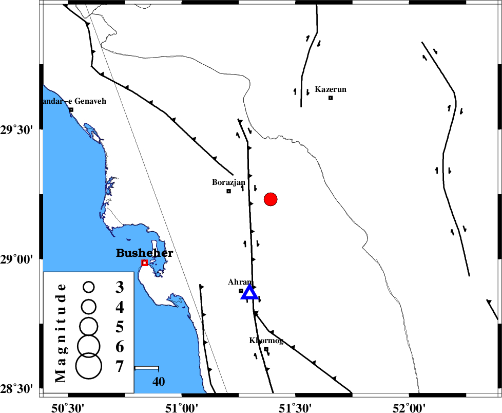
| Location | Lat:29.23 Lon: 51.39 |
| Region | Bushehr Province, 18 km East of Borazjan |
Nearest Cities |
|
| 18 km East of Borazjan, Bushehr Province | |
| 18 km North East of Sarkareh, Bushehr Province | |
| 24 km South of Dalki, Bushehr Province | |
| 26 km South East of Nazar aqa, Bushehr Province | |
| 31 km South East of Saedabad, Bushehr Province | |
| Depth | 8 km |
| Agency | |
Faults within 150 km: |
|
| BORAZJAN_F (Length: 168 km) , Distance to epicenter: 10 km | |
| ZFF3 (Length: 125 km) , Distance to epicenter: 19 km | |
| KAZERUN_F (Length: 96 km) , Distance to epicenter: 42 km | |
| Number of Phases | 6 |
| RMS | 0.1 |
| Number of Stations | 6 |
| Error in Latitude | >3.7 km |
| Error in Longitude | 4.2 km |
| Error in Depth | 10.8 km |
Download waveform in seisan format
to download seisan software Click here
to access information about IIEES stations Click here
Amplitude | ||||||||
| UID | Agency | Station | Component | Amplitude | Period | Arrival Time | Proccessing Time | Signal Clip |
| 91241 | IIEES | SHGR | E | 156 | 0.6 | 2013-12-19 18:56:55 | 2013-12-19 07:41:00 | n |
| 91242 | IIEES | SHGR | N | 136.6 | 0.56 | 2013-12-19 18:57:22 | 2013-12-19 07:41:00 | n |
Phase | ||||||||||||
| Agency | Station | Component | Phase Type | Phase Quality | First Motion | Observed Arrival Time | Time Residual | Loc. Flag | Input Weight | Distance | Azimuth | |
| IIEES | AHRM | Z | Pg | E | 2013-12-19 18:55:17 | 0 | y | 41.5 | 192 | |||
| IIEES | AHRM | E | Sg | E | 2013-12-19 18:55:22 | 0 | y | 41.5 | 192 | |||
| IIEES | KHMZ | Z | Pn | E | 2013-12-19 18:56:22 | -0.09 | y | 518 | 345 | |||
| IIEES | KRBR | Z | Pn | E | 2013-12-19 18:56:23 | 0 | y | 527 | 80 | |||
| IIEES | GHVR | Z | Pn | E | 2013-12-19 18:56:30 | -0.01 | y | 582 | 359 | |||
| IIEES | ASAO | Z | Pn | E | 2013-12-19 18:56:33 | 0.11 | y | 603 | 348 | |||