
Magnitude |
2.2 |
| Date & Time (UTC) | 2013-12-25 01:36:58.1 |
| Date & Time (Local) | 1392/10/4 05:06:58.1 |
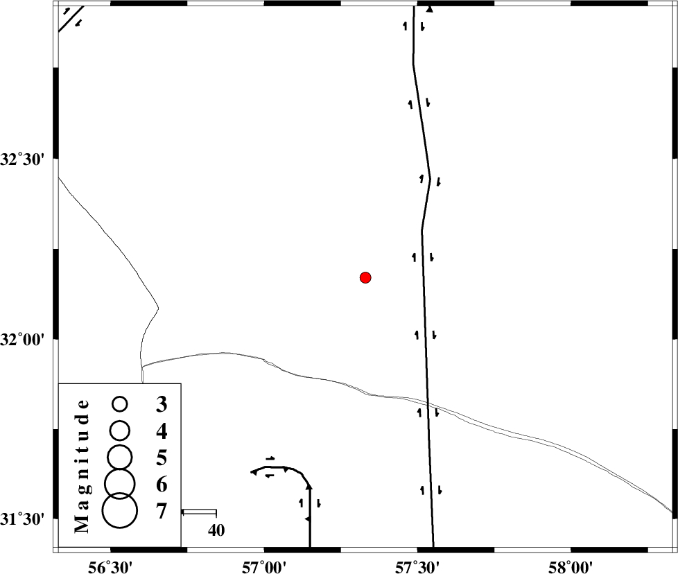
| Location | Lat:32.17 Lon: 57.33 |
| Region | Yazd Province, 112 km North-East of Ravar |
Nearest Cities |
|
| 12 km North West of Hoz-e qorban, Yazd Province | |
| 105 km South West of Arababad, Yazd Province | |
| 107 km North East of Dehali, Kerman Province | |
| 112 km North East of Ravar, Kerman Province | |
| 118 km North East of Asfih, Yazd Province | |
| Depth | 14 km |
| Agency | |
Faults within 150 km: |
|
| NAYBAND_F (Length: 258 km) , Distance to epicenter: 23 km | |
| LAKARKUH_F (Length: 138 km) , Distance to epicenter: 63 km | |
| ESFARDIAR_F (Length: 94 km) , Distance to epicenter: 84 km | |
| Number of Phases | 5 |
| RMS | 0.1 |
| Number of Stations | 3 |
| Error in Latitude | >3.7 km |
| Error in Longitude | 4.4 km |
| Error in Depth | 11.9 km |
Download waveform in seisan format
to download seisan software Click here
to access information about IIEES stations Click here
Amplitude | ||||||||
| UID | Agency | Station | Component | Amplitude | Period | Arrival Time | Proccessing Time | Signal Clip |
| 91260 | IIEES | YZKH | E | 12.6 | 0.56 | 2013-12-25 01:38:10 | 2013-12-25 03:21:00 | n |
Phase | ||||||||||||
| Agency | Station | Component | Phase Type | Phase Quality | First Motion | Observed Arrival Time | Time Residual | Loc. Flag | Input Weight | Distance | Azimuth | |
| IIEES | TABS | Z | Pg | E | 2013-12-25 01:37:25 | -0.11 | y | 165 | 353 | |||
| IIEES | TABS | N | Sg | E | 2013-12-25 01:37:45 | 0.07 | y | 165 | 353 | |||
| IIEES | BSRN | Z | Pg | E | 2013-12-25 01:37:26 | 0.11 | y | 171 | 97 | |||
| IIEES | BSRN | N | Sg | E | 2013-12-25 01:37:47 | -0.06 | y | 171 | 97 | |||
| IIEES | YZKH | Z | Pn | E | 2013-12-25 01:37:38 | 0 | y | 259 | 276 | |||