
Magnitude |
4 |
| Date & Time (UTC) | 2013-12-27 11:25:28.7 |
| Date & Time (Local) | 1392/10/6 14:55:28.7 |
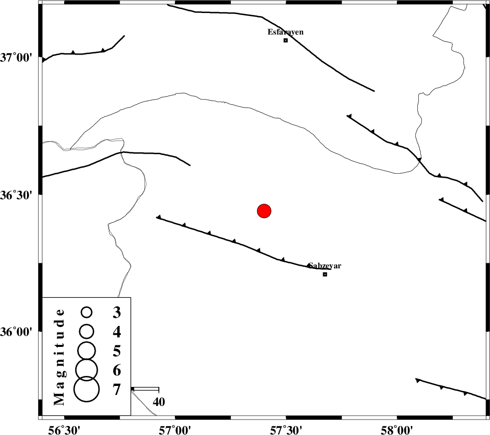
| Location | Lat:36.44 Lon: 57.4 |
| Region | Khorasan(center) Province, 35 km North-West of Sabzevar |
Nearest Cities |
|
| 17 km West of Void, Khorasan(center) Province | |
| 24 km North of Rivand, Khorasan(center) Province | |
| 28 km South West of Hokmabad, Khorasan(center) Province | |
| 29 km South East of Abuchenari, Khorasan(center) Province | |
| 30 km South of Neghab, Khorasan(center) Province | |
| Depth | 14 km |
| Agency | |
Faults within 150 km: |
|
| SABZEVAR_F (Length: 81 km) , Distance to epicenter: 16 km | |
| JOGHATAI_F (Length: 70 km) , Distance to epicenter: 35 km | |
| RIVAND_F (Length: 70 km) , Distance to epicenter: 51 km | |
| Number of Phases | 5 |
| RMS | 0.1 |
| Number of Stations | 6 |
| Error in Latitude | >4.5 km |
| Error in Longitude | 6.2 km |
| Error in Depth | 11.6 km |
Download waveform in seisan format
to download seisan software Click here
to access information about IIEES stations Click here
Amplitude | ||||||||
| UID | Agency | Station | Component | Amplitude | Period | Arrival Time | Proccessing Time | Signal Clip |
| 91278 | IIEES | TABS | N | 454.6 | 0.68 | 2013-12-27 11:27:07 | 2013-12-27 11:54:00 | n |
| 91279 | IIEES | YZKH | E | 162 | 0.6 | 2013-12-27 11:28:02 | 2013-12-27 11:54:00 | n |
| 91280 | IIEES | YZKH | N | 114.5 | 0.68 | 2013-12-27 11:28:18 | 2013-12-27 11:54:00 | n |
| 91281 | IIEES | KRBR | E | 37.4 | 0.72 | 2013-12-27 11:29:04 | 2013-12-27 11:54:00 | n |
Phase | ||||||||||||
| Agency | Station | Component | Phase Type | Phase Quality | First Motion | Observed Arrival Time | Time Residual | Loc. Flag | Input Weight | Distance | Azimuth | |
| IIEES | SHRO | E | Pg | E | 2013-12-27 11:25:50 | -0.1 | y | 133 | 250 | |||
| IIEES | BJRD | Z | Pg | E | 2013-12-27 11:25:52 | 0.05 | y | 140 | 0 | |||
| IIEES | TABS | Z | Pn | E | 2013-12-27 11:26:15 | 0.07 | y | 310 | 185 | |||
| IIEES | SHRT | Z | Pn | E | 2013-12-27 11:26:26 | -0.16 | y | 407 | 139 | |||
| IIEES | YZKH | Z | Pn | E | 2013-12-27 11:26:41 | 0.17 | y | 517 | 211 | |||