
Magnitude |
3.6 |
| Date & Time (UTC) | 2013-12-29 13:27:21.3 |
| Date & Time (Local) | 1392/10/8 16:57:21.3 |
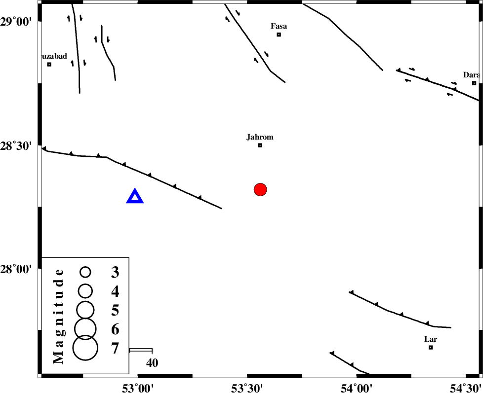
| Location | Lat:28.32 Lon: 53.56 |
| Region | Fars Province, 20 km South of Jahrom |
Nearest Cities |
|
| 10 km of Hasanabad, Fars Province | |
| 19 km North of Balafan, Fars Province | |
| 20 km South of Jahrom, Fars Province | |
| 23 km South West of Khorramabad, Fars Province | |
| 24 km East of Mobarakabad, Fars Province | |
| Depth | 17 km |
| Agency | |
Faults within 150 km: |
|
| QIR_F (Length: 130 km) , Distance to epicenter: 19 km | |
| SARVESTAN_F (Length: 94 km) , Distance to epicenter: 49 km | |
| BERIZ_F (Length: 49 km) , Distance to epicenter: 61 km | |
| Number of Phases | 6 |
| RMS | 0 |
| Number of Stations | 4 |
| Error in Latitude | >2 km |
| Error in Longitude | 1.4 km |
| Error in Depth | 4.5 km |
Download waveform in seisan format
to download seisan software Click here
to access information about IIEES stations Click here
Amplitude | ||||||||
| UID | Agency | Station | Component | Amplitude | Period | Arrival Time | Proccessing Time | Signal Clip |
| 91310 | IIEES | AHRM | N | 403.8 | 0.56 | 2013-12-29 13:28:44 | 2013-12-29 01:53:00 | n |
Phase | ||||||||||||
| Agency | Station | Component | Phase Type | Phase Quality | First Motion | Observed Arrival Time | Time Residual | Loc. Flag | Input Weight | Distance | Azimuth | |
| IIEES | AHRM | Z | Pn | E | 2013-12-29 13:27:57 | 0.05 | y | 229 | 286 | |||
| IIEES | AHRM | E | Sg | E | 2013-12-29 13:28:26 | -0.02 | y | 229 | 286 | |||
| IIEES | BNDS | Z | Pn | E | 2013-12-29 13:28:03 | 0 | y | 277 | 111 | |||
| IIEES | KRBR | Z | Pn | E | 2013-12-29 13:28:13 | -0.01 | y | 362 | 59 | |||
| IIEES | YZKH | Z | Pn | E | 2013-12-29 13:28:26 | -0.06 | y | 462 | 12 | |||
| IIEES | YZKH | E | Sg | E | 2013-12-29 13:29:30 | 0.03 | y | 462 | 12 | |||