
Magnitude |
2.3 |
| Date & Time (UTC) | 2014-01-03 02:44:02.9 |
| Date & Time (Local) | 1392/10/13 06:14:02.9 |
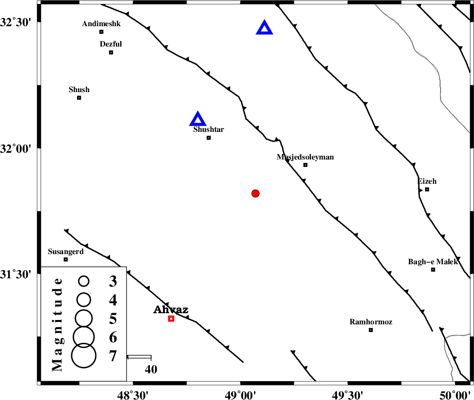
| Location | Lat:31.82 Lon: 49.07 |
| Region | Khoozestan Province, 25 km South-West of Masjed Soleyman |
Nearest Cities |
|
| 17 km East of Arabhasan, Khoozestan Province | |
| 25 km South West of Masjed Soleyman, Khoozestan Province | |
| 26 km South East of Mehdiabad, Khoozestan Province | |
| 28 km North East of Talieh, Khoozestan Province | |
| 32 km North East of Mollasani, Khoozestan Province | |
| Depth | 17 km |
| Agency | |
Faults within 150 km: |
|
| DEZFUL_EMBAYMENT (Length: 228 km) , Distance to epicenter: 20 km | |
| MFF2 (Length: 205 km) , Distance to epicenter: 60 km | |
| AHVAZ_F (Length: 99 km) , Distance to epicenter: 63 km | |
| Number of Phases | 6 |
| RMS | 0.1 |
| Number of Stations | 4 |
| Error in Latitude | >7.1 km |
| Error in Longitude | 5.5 km |
| Error in Depth | 6.1 km |
Download waveform in seisan format
to download seisan software Click here
to access information about IIEES stations Click here
Amplitude | ||||||||
| UID | Agency | Station | Component | Amplitude | Period | Arrival Time | Proccessing Time | Signal Clip |
| 91364 | IIEES | KHMZ | E | 19.5 | 0.6 | 2014-01-03 02:45:11 | 2014-01-03 03:19:00 | n |
| 91365 | IIEES | ASAO | E | 9.2 | 0.52 | 2014-01-03 02:45:48 | 2014-01-03 03:19:00 | n |
| 91366 | IIEES | GHVR | E | 7.2 | 0.52 | 2014-01-03 02:45:47 | 2014-01-03 03:19:00 | n |
Phase | ||||||||||||
| Agency | Station | Component | Phase Type | Phase Quality | First Motion | Observed Arrival Time | Time Residual | Loc. Flag | Input Weight | Distance | Azimuth | |
| IIEES | SHGR | Z | Pg | E | 2014-01-03 02:44:10 | 0 | y | 40.9 | 322 | |||
| IIEES | KHMZ | Z | Pn | E | 2014-01-03 02:44:38 | -0.1 | y | 229 | 21 | |||
| IIEES | KHMZ | N | Sg | E | 2014-01-03 02:45:07 | 0.06 | y | 229 | 21 | |||
| IIEES | ASAO | Z | Pn | E | 2014-01-03 02:44:49 | -0.02 | y | 315 | 16 | |||
| IIEES | GHVR | Z | Pn | E | 2014-01-03 02:44:54 | 0.14 | y | 358 | 34 | |||
| IIEES | GHVR | N | Sg | E | 2014-01-03 02:45:43 | -0.07 | y | 358 | 34 | |||