
Magnitude |
2.9 |
| Date & Time (UTC) | 2014-01-03 17:49:09.1 |
| Date & Time (Local) | 1392/10/13 21:19:09.1 |
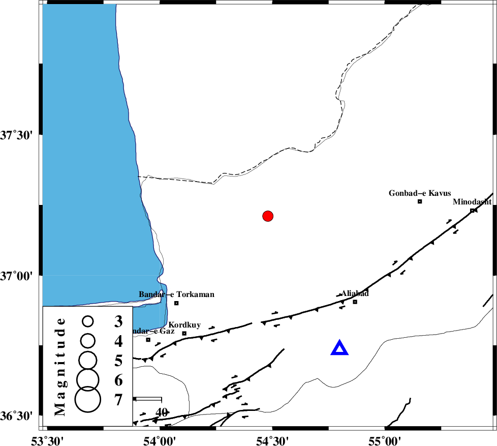
| Location | Lat:37.21 Lon: 54.48 |
| Region | Golestan Province, 22 km North of Aq Qaleh |
Nearest Cities |
|
| 22 km North of Qanqarmeh, Golestan Province | |
| 22 km North of Aq Qaleh, Golestan Province | |
| 27 km North West of Gariduji, Golestan Province | |
| 28 km North West of Nodeh malek, Golestan Province | |
| 31 km North East of Banavar, Golestan Province | |
| Depth | 17 km |
| Agency | |
Faults within 150 km: |
|
| KHAZAR_F (Length: 523 km) , Distance to epicenter: 40 km | |
| N_ALBORZ_F (Length: 360 km) , Distance to epicenter: 67 km | |
| SHAVAR_F (Length: 87 km) , Distance to epicenter: 72 km | |
| Number of Phases | 6 |
| RMS | 0 |
| Number of Stations | 4 |
| Error in Latitude | >1.7 km |
| Error in Longitude | 2 km |
| Error in Depth | 4.5 km |
Download waveform in seisan format
to download seisan software Click here
to access information about IIEES stations Click here
Amplitude | ||||||||
| UID | Agency | Station | Component | Amplitude | Period | Arrival Time | Proccessing Time | Signal Clip |
| 91369 | IIEES | DAMV | E | 48.9 | 0.28 | 2014-01-03 17:50:37 | 2014-01-03 06:14:00 | n |
Phase | ||||||||||||
| Agency | Station | Component | Phase Type | Phase Quality | First Motion | Observed Arrival Time | Time Residual | Loc. Flag | Input Weight | Distance | Azimuth | |
| IIEES | SHRO | E | Pn | E | 2014-01-03 17:49:40 | 0.03 | y | 191 | 134 | |||
| IIEES | SHRO | E | Sg | E | 2014-01-03 17:50:03 | 0 | y | 191 | 134 | |||
| IIEES | BJRD | Z | Pn | E | 2014-01-03 17:49:49 | -0.02 | y | 265 | 77 | |||
| IIEES | BJRD | E | Sg | E | 2014-01-03 17:50:23 | 0 | y | 265 | 77 | |||
| IIEES | DAMV | Z | Pn | E | 2014-01-03 17:49:52 | -0.08 | y | 285 | 233 | |||
| IIEES | CHTH | Z | Pn | E | 2014-01-03 17:49:58 | 0.08 | y | 333 | 245 | |||