
Magnitude |
2.9 |
| Date & Time (UTC) | 2014-01-05 18:41:33.6 |
| Date & Time (Local) | 1392/10/15 22:11:33.6 |
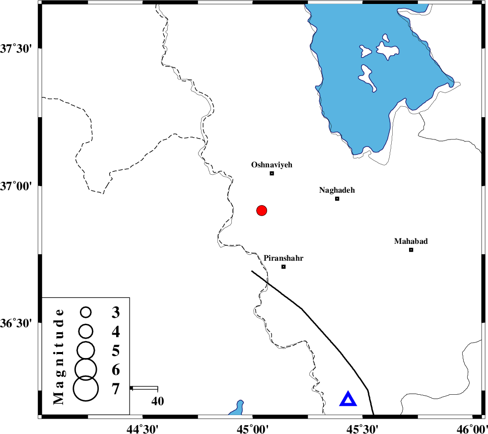
| Location | Lat:36.91 Lon: 45.04 |
| Region | Azarbaijan Gharbi Province, 16 km South of Oshnaviyeh |
Nearest Cities |
|
| 12 km of Nalus, Azarbaijan Gharbi Province | |
| 13 km North of Silveh, Azarbaijan Gharbi Province | |
| 16 km South of Oshnaviyeh, Azarbaijan Gharbi Province | |
| 21 km North West of Darikeh, Azarbaijan Gharbi Province | |
| 23 km North West of Kardkeshaneh, Azarbaijan Gharbi Province | |
| Depth | 14 km |
| Agency | |
Faults within 150 km: |
|
| PIRANSHAHR_F (Length: 253 km) , Distance to epicenter: 25 km | |
| SALMAS (Length: 20 km) , Distance to epicenter: 128 km | |
| N_TABRIZ_F2 (Length: 52 km) , Distance to epicenter: 147 km | |
| Number of Phases | 5 |
| RMS | 0.1 |
| Number of Stations | 3 |
| Error in Latitude | >1.3 km |
| Error in Longitude | 5.5 km |
| Error in Depth | 7.3 km |
Download waveform in seisan format
to download seisan software Click here
to access information about IIEES stations Click here
Amplitude | ||||||||
| UID | Agency | Station | Component | Amplitude | Period | Arrival Time | Proccessing Time | Signal Clip |
| 91379 | IIEES | SNGE | E | 48.9 | 0.56 | 2014-01-05 18:43:06 | 2014-01-05 07:53:00 | n |
| 91380 | IIEES | SNGE | N | 45 | 0.68 | 2014-01-05 18:43:09 | 2014-01-05 07:53:00 | n |
Phase | ||||||||||||
| Agency | Station | Component | Phase Type | Phase Quality | First Motion | Observed Arrival Time | Time Residual | Loc. Flag | Input Weight | Distance | Azimuth | |
| IIEES | MAKU | Z | Pn | E | 2014-01-05 18:42:15 | -0.08 | y | 273 | 354 | |||
| IIEES | SNGE | Z | Pn | E | 2014-01-05 18:42:17 | 0.11 | y | 290 | 133 | |||
| IIEES | SNGE | E | Sg | E | 2014-01-05 18:42:55 | -0.08 | y | 290 | 133 | |||
| IIEES | GRMI | Z | Pn | E | 2014-01-05 18:42:22 | 0.05 | y | 328 | 49 | |||
| IIEES | GRMI | E | Sg | E | 2014-01-05 18:43:05 | 0 | y | 328 | 49 | |||