
Magnitude |
1.7 |
| Date & Time (UTC) | 2014-01-09 14:00:01.1 |
| Date & Time (Local) | 1392/10/19 17:30:01.1 |
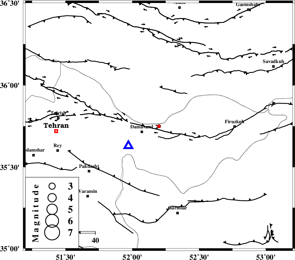
| Location | Lat:35.75 Lon: 52.2 |
| Region | Tehran Province, 13 km East of Damavand |
Nearest Cities |
|
| 12 km North East of Damavand, Tehran Province | |
| 15 km North West of Sarbandan, Tehran Province | |
| 15 km South of Rineh, Mazandaran Province | |
| 16 km North of Mara, Tehran Province | |
| 17 km South of Gaznak, Mazandaran Province | |
| Depth | 14 km |
| Agency | |
Faults within 150 km: |
|
| MOSHA_F (Length: 234 km) , Distance to epicenter: 9 km | |
| N_TEHRAN_F4 (Length: 115 km) , Distance to epicenter: 38 km | |
| EYVANEKEY_F (Length: 74 km) , Distance to epicenter: 45 km | |
| Number of Phases | 4 |
| RMS | 0.1 |
| Number of Stations | 3 |
| Error in Latitude | >3.3 km |
| Error in Longitude | 5.6 km |
| Error in Depth | 3.4 km |
Download waveform in seisan format
to download seisan software Click here
to access information about IIEES stations Click here
Amplitude | ||||||||
| UID | Agency | Station | Component | Amplitude | Period | Arrival Time | Proccessing Time | Signal Clip |
| 91421 | IIEES | ASAO | N | 4.7 | 0.4 | 2014-01-09 14:01:13 | 2014-01-10 03:40:00 | n |
Phase | ||||||||||||
| Agency | Station | Component | Phase Type | Phase Quality | First Motion | Observed Arrival Time | Time Residual | Loc. Flag | Input Weight | Distance | Azimuth | |
| IIEES | DAMV | Z | Pg | E | 2014-01-09 14:00:06 | -0.1 | y | 24.9 | 238 | |||
| IIEES | CHTH | Z | Pg | E | 2014-01-09 14:00:18 | 0 | y | 99 | 281 | |||
| IIEES | ASAO | Z | Pn | E | 2014-01-09 14:00:38 | 0.08 | y | 239 | 237 | |||
| IIEES | ASAO | E | Sg | E | 2014-01-09 14:01:09 | 0.01 | y | 239 | 237 | |||