
Magnitude |
1.6 |
| Date & Time (UTC) | 2014-01-09 09:35:38.8 |
| Date & Time (Local) | 1392/10/19 13:05:38.8 |
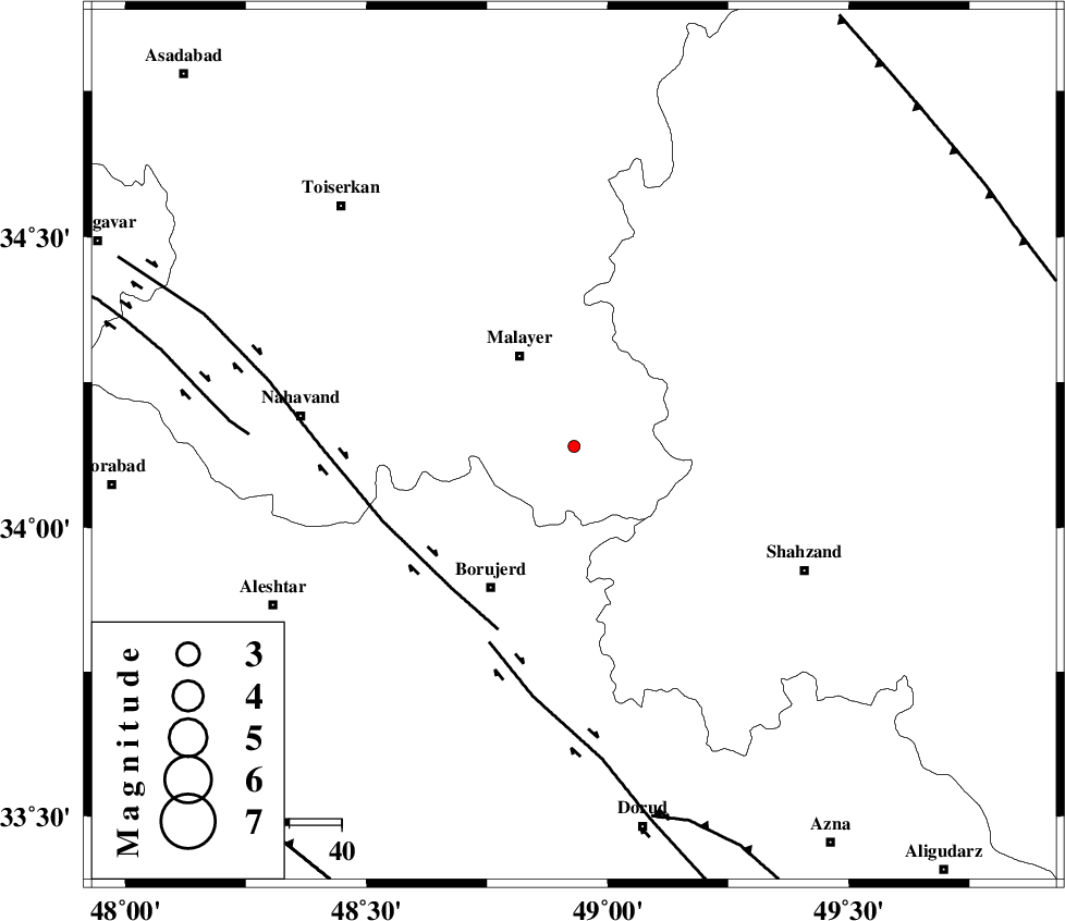
| Location | Lat:34.14 Lon: 48.93 |
| Region | Hamedan Province, 20 km South-East of Malayer |
Nearest Cities |
|
| 8 km North of Mahdaviye, Hamedan Province | |
| 10 km North of Pirooz, Hamedan Province | |
| 10 km West of Zangeh olia, Hamedan Province | |
| 11 km of Jurab, Hamedan Province | |
| 13 km South of Jozan, Hamedan Province | |
| Depth | 15 km |
| Agency | |
Faults within 150 km: |
|
| NAHAVAND_F (Length: 102 km) , Distance to epicenter: 36 km | |
| DORUD (Length: 100 km) , Distance to epicenter: 41 km | |
| SAHANEH_F (Length: 77 km) , Distance to epicenter: 62 km | |
| Number of Phases | 3 |
| RMS | 0 |
| Number of Stations | 3 |
| Error in Latitude | >3.2 km |
| Error in Longitude | 2.1 km |
| Error in Depth | 0 km |
Download waveform in seisan format
to download seisan software Click here
to access information about IIEES stations Click here
Amplitude | ||||||||
| UID | Agency | Station | Component | Amplitude | Period | Arrival Time | Proccessing Time | Signal Clip |
| 91424 | IIEES | SNGE | N | 6.5 | 0.24 | 2014-01-09 09:36:33 | 2014-01-10 03:58:00 | n |
Phase | ||||||||||||
| Agency | Station | Component | Phase Type | Phase Quality | First Motion | Observed Arrival Time | Time Residual | Loc. Flag | Input Weight | Distance | Azimuth | |
| IIEES | KHMZ | Z | Pg | E | 2014-01-09 09:35:56 | -0.01 | y | 105 | 115 | |||
| IIEES | ASAO | Z | Pg | E | 2014-01-09 09:35:57 | 0 | y | 111 | 65 | |||
| IIEES | SNGE | Z | Pn | E | 2014-01-09 09:36:08 | 0.01 | y | 180 | 307 | |||