
Magnitude |
2.8 |
| Date & Time (UTC) | 2014-01-10 14:30:31.8 |
| Date & Time (Local) | 1392/10/20 18:00:31.8 |
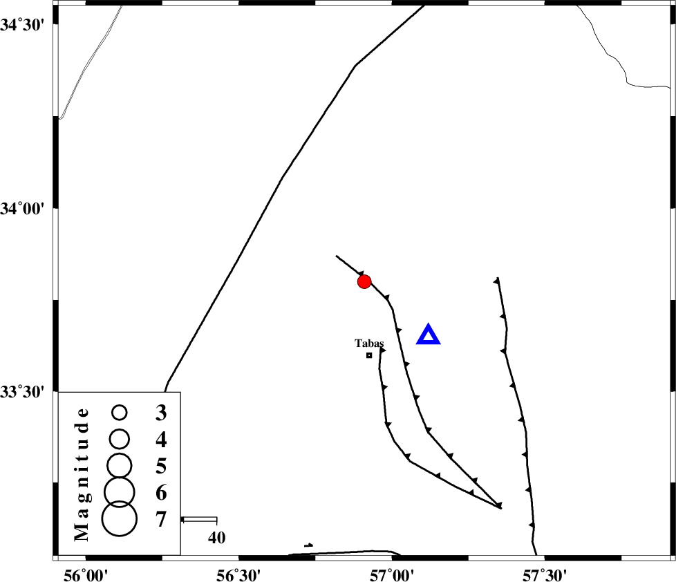
| Location | Lat:33.8 Lon: 56.91 |
| Region | Yazd Province, 23 km North of Tabas |
Nearest Cities |
|
| 14 km North East of Jokhvah, Yazd Province | |
| 22 km North of Tabas, Yazd Province | |
| 27 km North of Oshtoqran, Yazd Province | |
| 32 km West of Reqqeh, Khorasan(center) Province | |
| 39 km North of Kerit, Yazd Province | |
| Depth | 19 km |
| Agency | |
Faults within 150 km: |
|
| TABAS_F1 (Length: 91 km) , Distance to epicenter: 1 km | |
| TABAS_F2 (Length: 67 km) , Distance to epicenter: 20 km | |
| NAINI_F (Length: 342 km) , Distance to epicenter: 39 km | |
| Number of Phases | 4 |
| RMS | 0 |
| Number of Stations | 3 |
| Error in Latitude | >9.6 km |
| Error in Longitude | 3.3 km |
| Error in Depth | 3.1 km |
Download waveform in seisan format
to download seisan software Click here
to access information about IIEES stations Click here
Amplitude | ||||||||
| UID | Agency | Station | Component | Amplitude | Period | Arrival Time | Proccessing Time | Signal Clip |
| 91432 | IIEES | TABS | N | 1792.1 | 0.32 | 2014-01-10 14:30:43 | 2014-01-10 02:52:00 | n |
| 91433 | IIEES | TABS | E | 938.7 | 0.32 | 2014-01-10 14:30:43 | 2014-01-10 02:52:00 | n |
Phase | ||||||||||||
| Agency | Station | Component | Phase Type | Phase Quality | First Motion | Observed Arrival Time | Time Residual | Loc. Flag | Input Weight | Distance | Azimuth | |
| IIEES | TABS | Z | Pg | E | 2014-01-10 14:30:37 | 0 | y | 25.9 | 132 | |||
| IIEES | TABS | E | Sg | E | 2014-01-10 14:30:41 | 0 | y | 25.9 | 132 | |||
| IIEES | YZKH | Z | Pn | E | 2014-01-10 14:31:12 | 0 | y | 267 | 235 | |||
| IIEES | BSRN | Z | Pn | E | 2014-01-10 14:31:15 | 0 | y | 291 | 134 | |||