
Magnitude |
2.6 |
| Date & Time (UTC) | 2014-01-11 12:22:56.4 |
| Date & Time (Local) | 1392/10/21 15:52:56.4 |
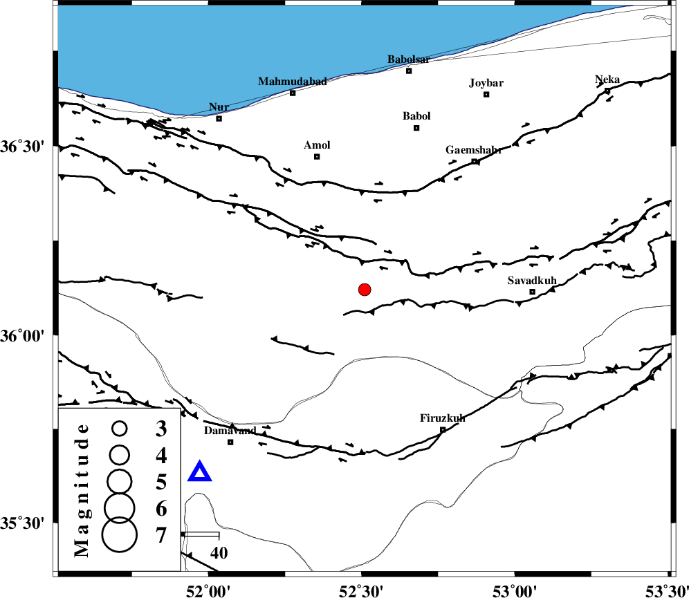
| Location | Lat:36.12 Lon: 52.51 |
| Region | Mazandaran Province, 42 km South-East of Amol |
Nearest Cities |
|
| 15 km West of Firoozjah-e sabet, Mazandaran Province | |
| 25 km North East of Baijan, Mazandaran Province | |
| 27 km South East of Razkeh, Mazandaran Province | |
| 28 km South of Khoshrud, Mazandaran Province | |
| 29 km North West of Alasht, Mazandaran Province | |
| Depth | 14 km |
| Agency | |
Faults within 150 km: |
|
| N_ALBORZ_F (Length: 360 km) , Distance to epicenter: 9 km | |
| KHAZAR_F (Length: 523 km) , Distance to epicenter: 29 km | |
| MOSHA_F (Length: 234 km) , Distance to epicenter: 47 km | |
| Number of Phases | 6 |
| RMS | 0.3 |
| Number of Stations | 4 |
| Error in Latitude | >6.9 km |
| Error in Longitude | 7.9 km |
| Error in Depth | 11.2 km |
Download waveform in seisan format
to download seisan software Click here
to access information about IIEES stations Click here
Amplitude | ||||||||
| UID | Agency | Station | Component | Amplitude | Period | Arrival Time | Proccessing Time | Signal Clip |
| 91441 | IIEES | GHVR | E | 49.7 | 0.72 | 2014-01-11 12:24:05 | 2014-01-11 02:32:00 | n |
Phase | ||||||||||||
| Agency | Station | Component | Phase Type | Phase Quality | First Motion | Observed Arrival Time | Time Residual | Loc. Flag | Input Weight | Distance | Azimuth | |
| IIEES | CHTH | Z | Pg | E | 2014-01-11 12:23:17 | -0.13 | y | 127 | 260 | |||
| IIEES | CHTH | N | Sg | E | 2014-01-11 12:23:33 | 0.34 | y | 127 | 260 | |||
| IIEES | THKV | Z | Pg | E | 2014-01-11 12:23:20 | -0.47 | y | 149 | 262 | |||
| IIEES | GHVR | Z | Pg | E | 2014-01-11 12:23:31 | -0.09 | y | 215 | 213 | |||
| IIEES | ASAO | Z | Pn | E | 2014-01-11 12:23:40 | 0.54 | y | 285 | 233 | |||
| IIEES | ASAO | E | Sg | E | 2014-01-11 12:24:16 | -0.18 | y | 285 | 233 | |||