
Magnitude |
3.7 |
| Date & Time (UTC) | 2014-01-12 07:31:03.2 |
| Date & Time (Local) | 1392/10/22 11:01:03.2 |
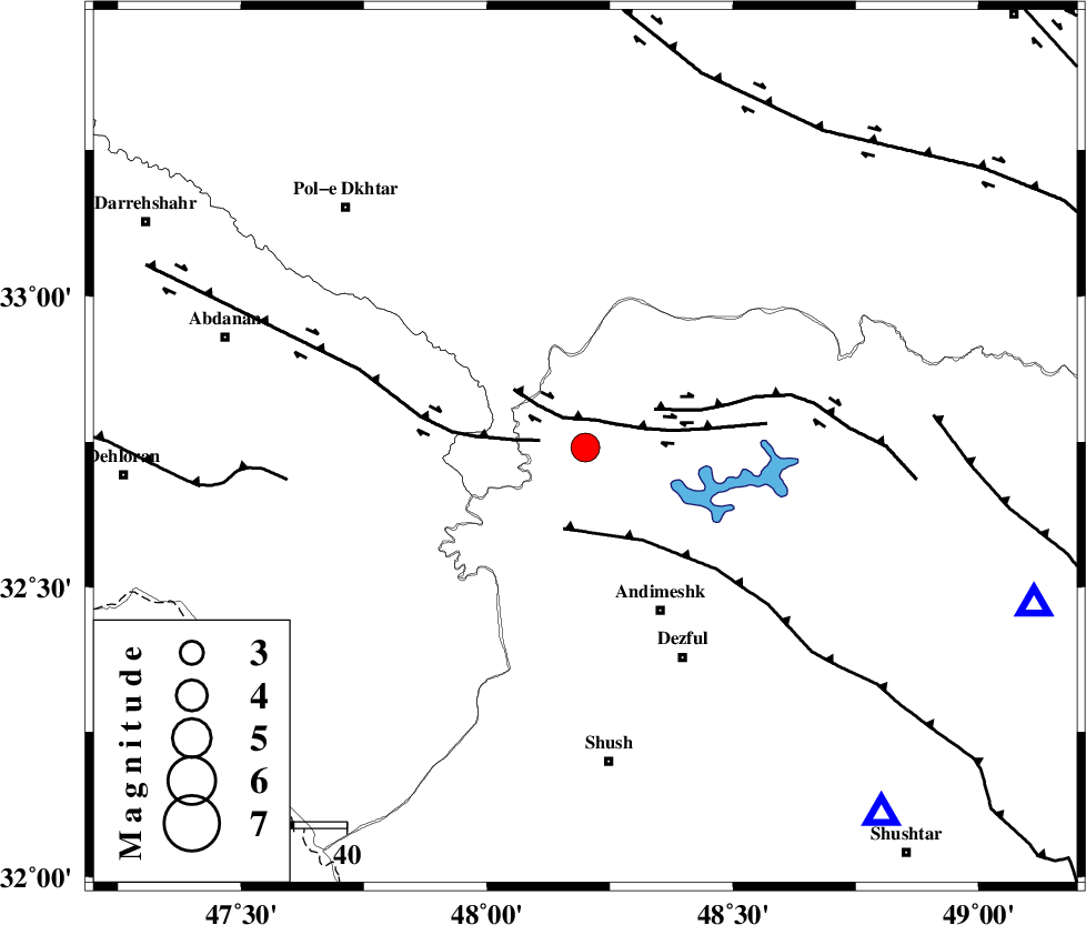
| Location | Lat:32.74 Lon: 48.2 |
| Region | Khoozestan Province, 35 km North-West of Andimeshk |
Nearest Cities |
|
| 4 km of Bidruyeh, Khoozestan Province | |
| 8 km North of Hoseinieh, Khoozestan Province | |
| 13 km West of Sorkhakan, Khoozestan Province | |
| 34 km North West of Andimeshk, Khoozestan Province | |
| 44 km North West of Dezful, Khoozestan Province | |
| Depth | 15 km |
| Agency | |
Faults within 150 km: |
|
| BALARUD_F_Z3 (Length: 53 km) , Distance to epicenter: 6 km | |
| BALARUD_F_Z1 (Length: 87 km) , Distance to epicenter: 9 km | |
| BALARUD_F_Z2 (Length: 58 km) , Distance to epicenter: 15 km | |
| Number of Phases | 8 |
| RMS | 0.4 |
| Number of Stations | 8 |
| Error in Latitude | >5.2 km |
| Error in Longitude | 9.8 km |
| Error in Depth | 9.1 km |
Download waveform in seisan format
to download seisan software Click here
to access information about IIEES stations Click here
Amplitude | ||||||||
| UID | Agency | Station | Component | Amplitude | Period | Arrival Time | Proccessing Time | Signal Clip |
| 91449 | IIEES | SHGR | N | 2183.5 | 0.43 | 2014-01-12 07:31:37 | 2014-01-12 08:00:00 | n |
| 91450 | IIEES | ASAO | E | 387.6 | 0.59 | 2014-01-12 07:32:22 | 2014-01-12 08:00:00 | n |
| 91451 | IIEES | ASAO | N | 397 | 0.56 | 2014-01-12 07:32:24 | 2014-01-12 08:00:00 | n |
| 91452 | IIEES | GHVR | E | 183.3 | 0.48 | 2014-01-12 07:32:34 | 2014-01-12 08:00:00 | n |
| 91453 | IIEES | GHVR | N | 192.4 | 0.34 | 2014-01-12 07:32:35 | 2014-01-12 08:00:00 | n |
Phase | ||||||||||||
| Agency | Station | Component | Phase Type | Phase Quality | First Motion | Observed Arrival Time | Time Residual | Loc. Flag | Input Weight | Distance | Azimuth | |
| IIEES | SHGR | Z | Pg | E | 2014-01-12 07:31:18 | -0.02 | y | 90.6 | 141 | |||
| IIEES | KHMZ | Z | Pg | E | 2014-01-12 07:31:35 | -0.53 | y | 199 | 56 | |||
| IIEES | ASAO | Z | Pn | E | 2014-01-12 07:31:43 | 0.12 | y | 263 | 40 | |||
| IIEES | SNGE | Z | Pn | E | 2014-01-12 07:31:44 | -0.29 | y | 272 | 343 | |||
| IIEES | GHVR | Z | Pn | E | 2014-01-12 07:31:53 | 0.3 | y | 342 | 55 | |||
| IIEES | THKV | Z | Pn | E | 2014-01-12 07:32:05 | 0.79 | y | 430 | 34 | |||
| IIEES | ZNJK | Z | Pn | E | 2014-01-12 07:32:05 | 0.11 | y | 438 | 6 | |||
| IIEES | CHTH | Z | Pn | E | 2014-01-12 07:32:05 | -0.3 | y | 443 | 37 | |||