
Magnitude |
2.5 |
| Date & Time (UTC) | 2014-01-15 18:00:21.9 |
| Date & Time (Local) | 1392/10/25 21:30:21.9 |
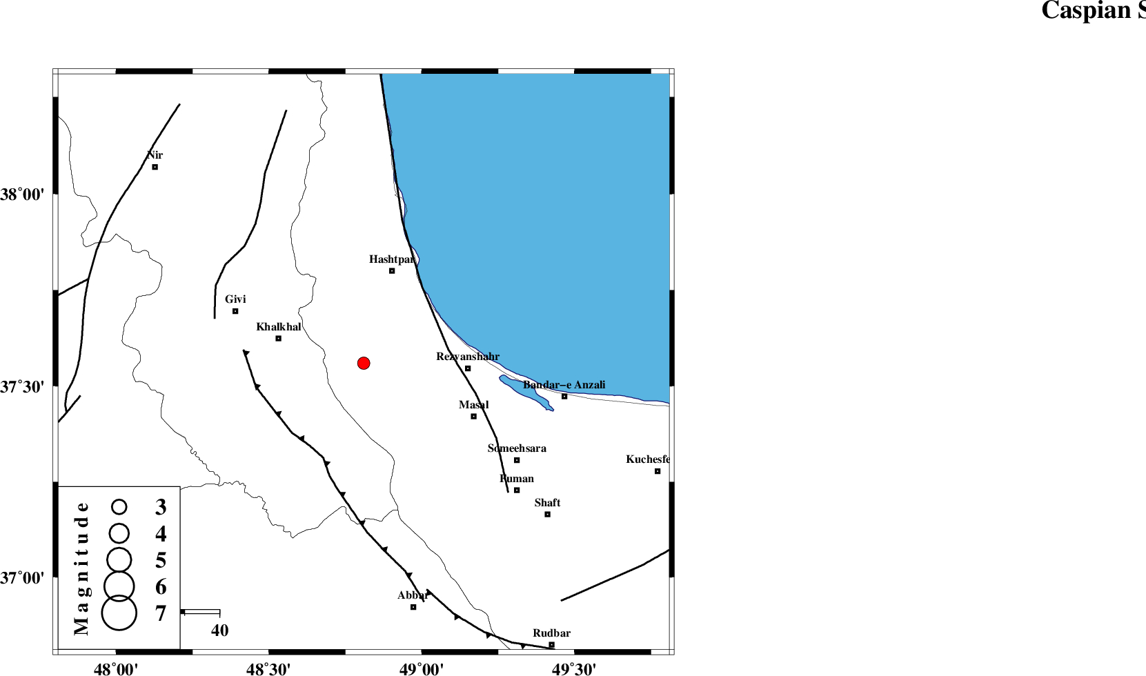
| Location | Lat:37.56 Lon: 48.81 |
| Region | Gilan Province, 28 km South of Hashtpar |
Nearest Cities |
|
| 6 km North of Ardeh, Gilan Province | |
| 21 km North of Kalur, Ardebil Province | |
| 23 km West of Parrehsar, Gilan Province | |
| 23 km East of Khojin, Ardebil Province | |
| 24 km West of Void, Gilan Province | |
| Depth | 14 km |
| Agency | |
Faults within 150 km: |
|
| TALESH_F (Length: 258 km) , Distance to epicenter: 25 km | |
| MASULEL_F (Length: 90 km) , Distance to epicenter: 29 km | |
| SANGAVAR_F (Length: 61 km) , Distance to epicenter: 45 km | |
| Number of Phases | 4 |
| RMS | 0 |
| Number of Stations | 3 |
| Error in Latitude | >1.9 km |
| Error in Longitude | 2.8 km |
| Error in Depth | 4.1 km |
Download waveform in seisan format
to download seisan software Click here
to access information about IIEES stations Click here
Amplitude | ||||||||
| UID | Agency | Station | Component | Amplitude | Period | Arrival Time | Proccessing Time | Signal Clip |
| 91498 | IIEES | GRMI | E | 76 | 0.24 | 2014-01-15 18:01:09 | 2014-01-15 08:50:00 | n |
Phase | ||||||||||||
| Agency | Station | Component | Phase Type | Phase Quality | First Motion | Observed Arrival Time | Time Residual | Loc. Flag | Input Weight | Distance | Azimuth | |
| IIEES | ZNJK | Z | Pg | E | 2014-01-15 18:00:38 | 0.01 | y | 99.4 | 186 | |||
| IIEES | GRMI | Z | Pg | E | 2014-01-15 18:00:48 | 0 | y | 160 | 330 | |||
| IIEES | CHTH | Z | Pn | E | 2014-01-15 18:01:04 | 0.01 | y | 276 | 131 | |||
| IIEES | CHTH | N | Sg | E | 2014-01-15 18:01:39 | -0.01 | y | 276 | 131 | |||