
Magnitude |
2.3 |
| Date & Time (UTC) | 2014-01-20 20:34:01.1 |
| Date & Time (Local) | 1392/11/1 00:04:01.1 |
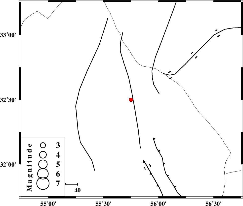
| Location | Lat:32.5 Lon: 55.75 |
| Region | Yazd Province, 105 km North-East of Bafq |
Nearest Cities |
|
| 60 km South East of Robat-e posht-e badam, Yazd Province | |
| 75 km North West of Behabad, Yazd Province | |
| 85 km North of Kushk, Yazd Province | |
| 91 km North West of Benestan, Yazd Province | |
| 102 km North East of Mobarake, Yazd Province | |
| Depth | 37 km |
| Agency | |
Faults within 150 km: |
|
| SARBALA_F (Length: 92 km) , Distance to epicenter: 6 km | |
| NAINI_F (Length: 342 km) , Distance to epicenter: 23 km | |
| CHESHMEH_ROSTAM_ (Length: 142 km) , Distance to epicenter: 35 km | |
| Number of Phases | 5 |
| RMS | 0 |
| Number of Stations | 4 |
| Error in Latitude | >3.6 km |
| Error in Longitude | 2.7 km |
| Error in Depth | 3.9 km |
Download waveform in seisan format
to download seisan software Click here
to access information about IIEES stations Click here
Amplitude | ||||||||
| UID | Agency | Station | Component | Amplitude | Period | Arrival Time | Proccessing Time | Signal Clip |
| 91556 | IIEES | KRBR | N | 11.9 | 0.56 | 2014-01-20 20:35:35 | 2014-01-20 08:58:00 | n |
Phase | ||||||||||||
| Agency | Station | Component | Phase Type | Phase Quality | First Motion | Observed Arrival Time | Time Residual | Loc. Flag | Input Weight | Distance | Azimuth | |
| IIEES | YZKH | Z | Pg | E | 2014-01-20 20:34:19 | -0.08 | y | 110 | 264 | |||
| IIEES | YZKH | N | Sg | E | 2014-01-20 20:34:33 | 0.06 | y | 110 | 264 | |||
| IIEES | TABS | Z | Pn | E | 2014-01-20 20:34:29 | -0.01 | y | 180 | 45 | |||
| IIEES | TABS | N | Sg | E | 2014-01-20 20:34:51 | 0.01 | y | 180 | 45 | |||
| IIEES | BSRN | Z | Pn | E | 2014-01-20 20:34:46 | 0.02 | y | 324 | 100 | |||