
Magnitude |
1.9 |
| Date & Time (UTC) | 2014-01-20 20:39:06.9 |
| Date & Time (Local) | 1392/11/1 00:09:06.9 |
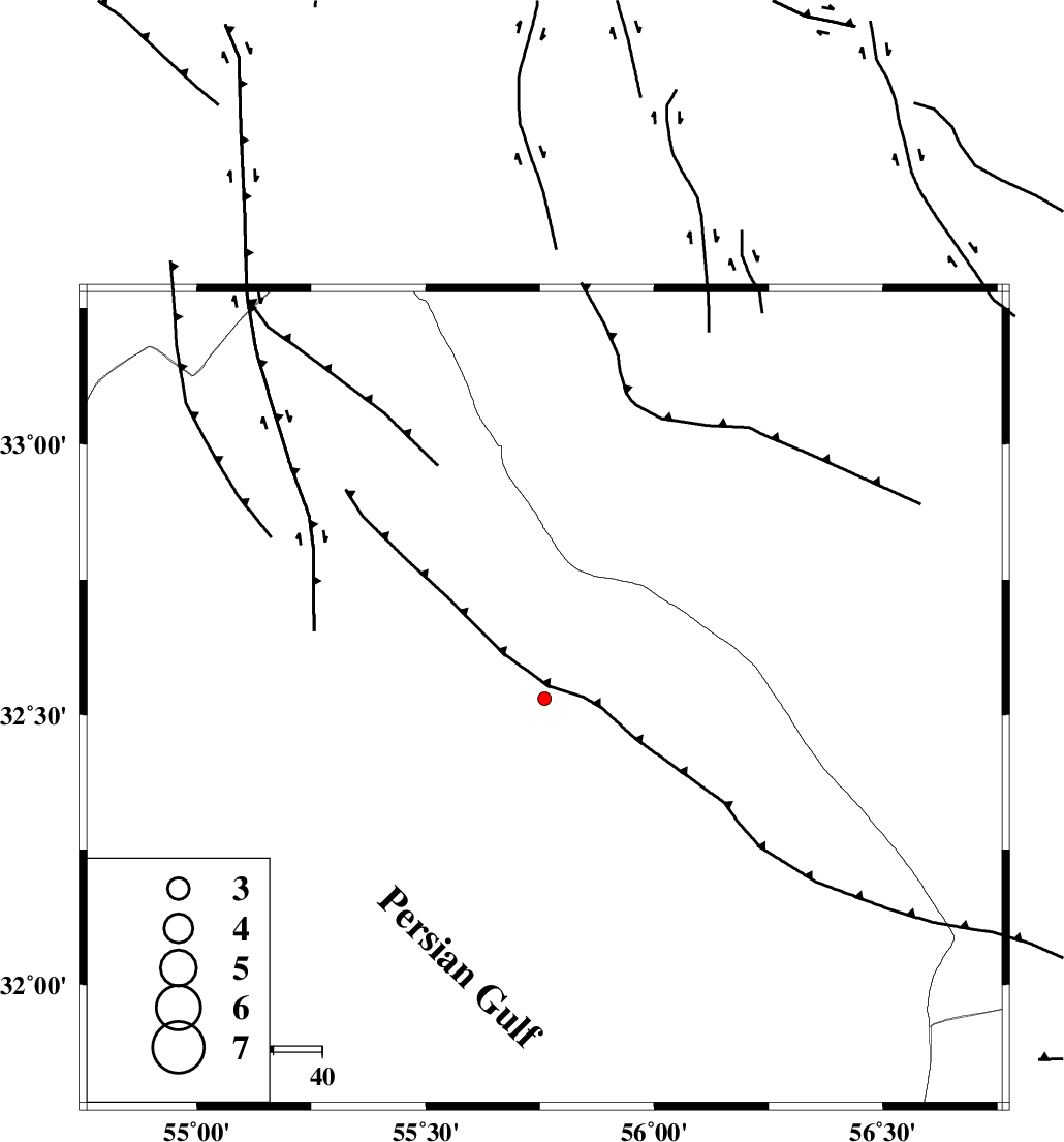
| Location | Lat:32.53 Lon: 55.76 |
| Region | Yazd Province, 109 km North-East of Bafq |
Nearest Cities |
|
| 57 km South East of Robat-e posht-e badam, Yazd Province | |
| 78 km North West of Behabad, Yazd Province | |
| 88 km North of Kushk, Yazd Province | |
| 94 km North West of Benestan, Yazd Province | |
| 101 km South East of Hajiabad, Yazd Province | |
| Depth | 32 km |
| Agency | |
Faults within 150 km: |
|
| SARBALA_F (Length: 92 km) , Distance to epicenter: 2 km | |
| NAINI_F (Length: 342 km) , Distance to epicenter: 21 km | |
| CHESHMEH_ROSTAM_ (Length: 142 km) , Distance to epicenter: 32 km | |
| Number of Phases | 5 |
| RMS | 0.1 |
| Number of Stations | 3 |
| Error in Latitude | >4.4 km |
| Error in Longitude | 3.2 km |
| Error in Depth | 5.1 km |
Download waveform in seisan format
to download seisan software Click here
to access information about IIEES stations Click here
Amplitude | ||||||||
| UID | Agency | Station | Component | Amplitude | Period | Arrival Time | Proccessing Time | Signal Clip |
| 91557 | IIEES | YZKH | N | 22.5 | 0.24 | 2014-01-20 20:39:43 | 2014-01-21 01:54:00 | n |
| 91558 | IIEES | TABS | N | 18.9 | 0.28 | 2014-01-20 20:39:58 | 2014-01-21 01:54:00 | n |
| 91559 | IIEES | TABS | E | 10.5 | 0.36 | 2014-01-20 20:39:58 | 2014-01-21 01:54:00 | n |
Phase | ||||||||||||
| Agency | Station | Component | Phase Type | Phase Quality | First Motion | Observed Arrival Time | Time Residual | Loc. Flag | Input Weight | Distance | Azimuth | |
| IIEES | YZKH | Z | Pg | E | 2014-01-20 20:39:25 | -0.18 | y | 111 | 262 | |||
| IIEES | YZKH | N | Sg | E | 2014-01-20 20:39:39 | 0.13 | y | 111 | 262 | |||
| IIEES | TABS | Z | Pn | E | 2014-01-20 20:39:35 | -0.02 | y | 177 | 45 | |||
| IIEES | TABS | N | Sg | E | 2014-01-20 20:39:56 | 0.02 | y | 177 | 45 | |||
| IIEES | BSRN | Z | Pn | E | 2014-01-20 20:39:53 | 0.05 | y | 323 | 100 | |||