
Magnitude |
4.1 |
| Date & Time (UTC) | 2014-01-22 03:26:41.2 |
| Date & Time (Local) | 1392/11/2 06:56:41.2 |
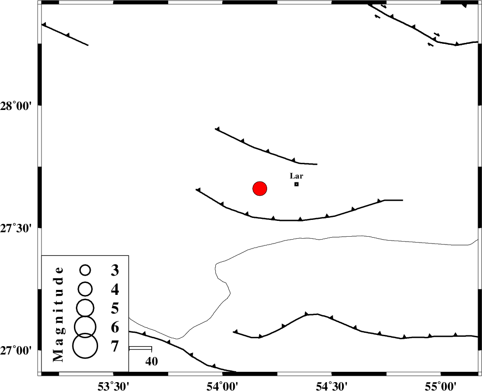
| Location | Lat:27.66 Lon: 54.17 |
| Region | Fars Province, 17 km West of Lar |
Nearest Cities |
|
| 1 km North of Grash, Fars Province | |
| 17 km West of Lar, Fars Province | |
| 19 km South East of Avaz, Fars Province | |
| 21 km West of Latifi, Fars Province | |
| 22 km North East of Bagh, Fars Province | |
| Depth | 15 km |
| Agency | |
Faults within 150 km: |
|
| LAR_F (Length: 99 km) , Distance to epicenter: 13 km | |
| BERIZ_F (Length: 49 km) , Distance to epicenter: 19 km | |
| MFF1 (Length: 180 km) , Distance to epicenter: 61 km | |
| Number of Phases | 8 |
| RMS | 0.5 |
| Number of Stations | 8 |
| Error in Latitude | >7.9 km |
| Error in Longitude | 3 km |
| Error in Depth | 0 km |
Download waveform in seisan format
to download seisan software Click here
to access information about IIEES stations Click here
Amplitude | ||||||||
| UID | Agency | Station | Component | Amplitude | Period | Arrival Time | Proccessing Time | Signal Clip |
| 91571 | IIEES | AHRM | E | 460.1 | 0.42 | 2014-01-22 03:28:29 | 2014-01-22 05:24:00 | n |
| 91572 | IIEES | AHRM | N | 825.7 | 0.4 | 2014-01-22 03:28:30 | 2014-01-22 05:24:00 | n |
Phase | ||||||||||||
| Agency | Station | Component | Phase Type | Phase Quality | First Motion | Observed Arrival Time | Time Residual | Loc. Flag | Input Weight | Distance | Azimuth | |
| IIEES | AHRM | Z | Pn | E | 2014-01-22 03:27:27 | 0.3 | y | 312 | 296 | |||
| IIEES | YZKH | Z | Pn | E | 2014-01-22 03:27:55 | 0.57 | y | 527 | 4 | |||
| IIEES | CHBR | Z | Pn | E | 2014-01-22 03:28:11 | -0.29 | y | 669 | 109 | |||
| IIEES | ZHSF | Z | Pn | E | 2014-01-22 03:28:13 | 0.3 | y | 681 | 70 | |||
| IIEES | TABS | Z | Pn | E | 2014-01-22 03:28:18 | -0.18 | y | 722 | 22 | |||
| IIEES | KHMZ | Z | Pn | E | 2014-01-22 03:28:25 | -0.95 | y | 786 | 330 | |||
| IIEES | GHVR | Z | Pn | E | 2014-01-22 03:28:28 | -0.62 | y | 806 | 341 | |||
| IIEES | SNGE | Z | Pn | E | 2014-01-22 03:28:59 | 0.01 | y | 1049 | 324 | |||