
Magnitude |
3.1 |
| Date & Time (UTC) | 2014-01-23 06:41:02.8 |
| Date & Time (Local) | 1392/11/3 10:11:02.8 |
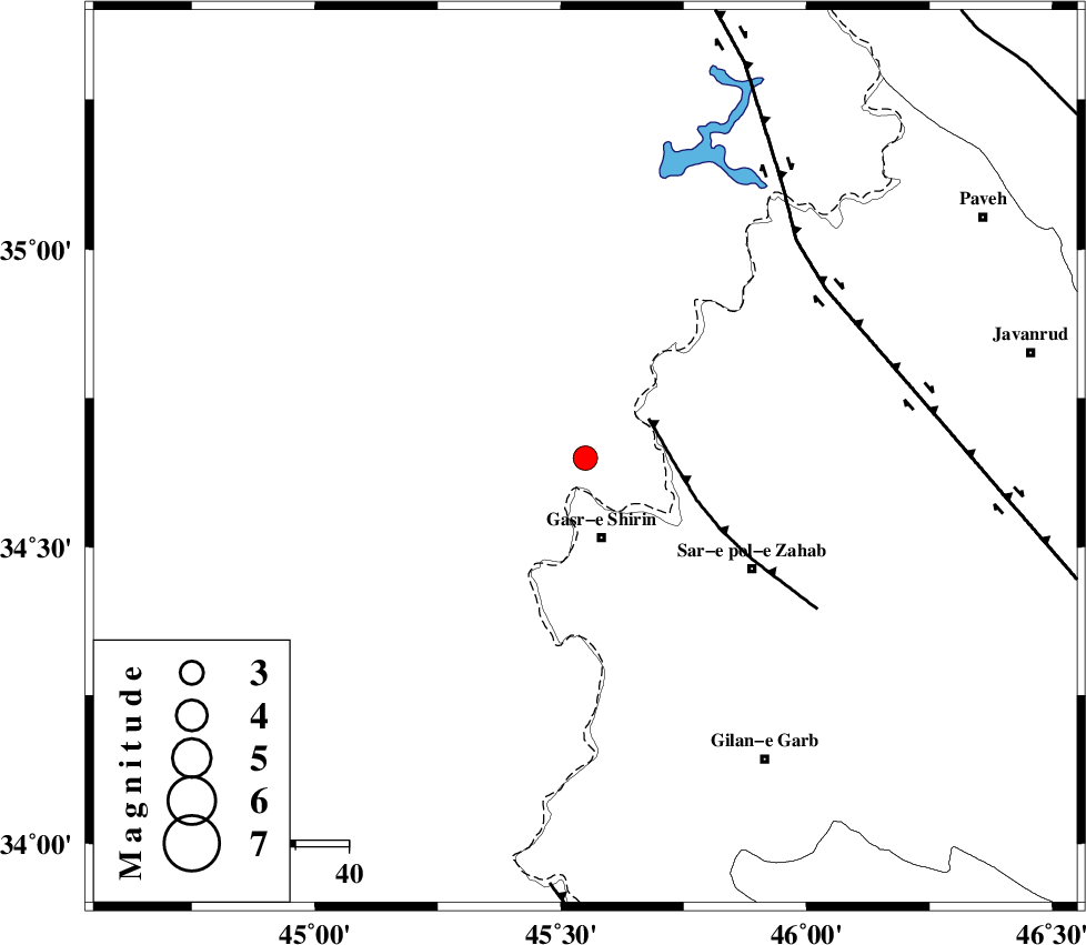
| Location | Lat:34.65 Lon: 45.55 |
| Region | Iraq, 16 km North of Qasr-E-Shirin |
Nearest Cities |
|
| 15 km North of Qasr-E-Shirin, Kermanshah Province | |
| 16 km North West of Aqabarar, Kermanshah Province | |
| 20 km South West of Tappeh rash, Kermanshah Province | |
| 22 km North West of Mirmiru, Kermanshah Province | |
| 23 km North of Seyyed sohrab, Kermanshah Province | |
| Depth | 39 km |
| Agency | |
Faults within 150 km: |
|
| MFF8 (Length: 48 km) , Distance to epicenter: 14 km | |
| HZF4 (Length: 492 km) , Distance to epicenter: 55 km | |
| ZFF4 (Length: 128 km) , Distance to epicenter: 80 km | |
| Number of Phases | 4 |
| RMS | 0 |
| Number of Stations | 3 |
| Error in Latitude | >6.2 km |
| Error in Longitude | 6 km |
| Error in Depth | 4.8 km |
Download waveform in seisan format
to download seisan software Click here
to access information about IIEES stations Click here
Amplitude | ||||||||
| UID | Agency | Station | Component | Amplitude | Period | Arrival Time | Proccessing Time | Signal Clip |
| 91587 | IIEES | SNGE | N | 219 | 0.48 | 2014-01-23 06:41:58 | 2014-01-23 11:35:00 | n |
Phase | ||||||||||||
| Agency | Station | Component | Phase Type | Phase Quality | First Motion | Observed Arrival Time | Time Residual | Loc. Flag | Input Weight | Distance | Azimuth | |
| IIEES | SNGE | Z | Pg | E | 2014-01-23 06:41:31 | 0 | y | 172 | 73 | |||
| IIEES | SNGE | N | Sg | E | 2014-01-23 06:41:51 | -0.01 | y | 172 | 73 | |||
| IIEES | ZNJK | Z | Pn | E | 2014-01-23 06:41:53 | 0.01 | y | 362 | 51 | |||
| IIEES | ASAO | E | Pn | E | 2014-01-23 06:41:59 | 0.01 | y | 411 | 90 | |||