
Magnitude |
2.4 |
| Date & Time (UTC) | 2014-01-27 00:56:23.1 |
| Date & Time (Local) | 1392/11/7 04:26:23.1 |
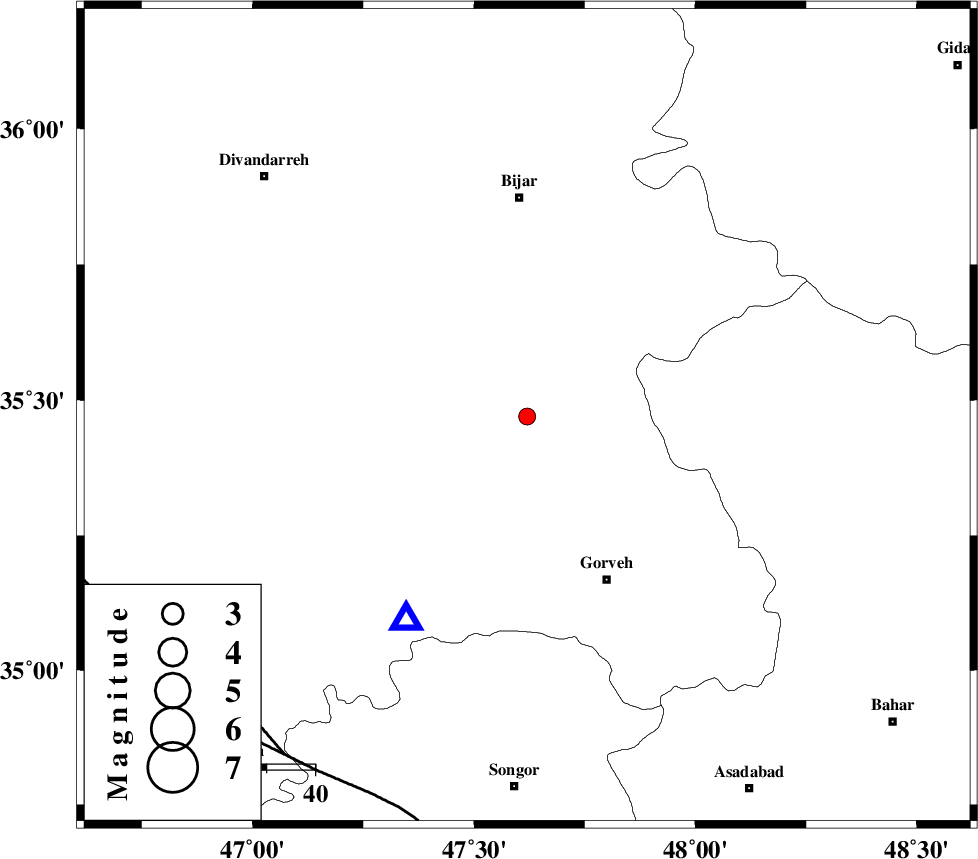
| Location | Lat:35.47 Lon: 47.62 |
| Region | Kurdistan Province, 45 km South of Bijar |
Nearest Cities |
|
| 6 km of Khosroabad, Kurdistan Province | |
| 24 km North West of Serishabad, Kurdistan Province | |
| 25 km North of Kani ganji, Kurdistan Province | |
| 27 km North East of Dehgolan, Kurdistan Province | |
| 29 km North East of Hasanabad, Kurdistan Province | |
| Depth | 14 km |
| Agency | |
Faults within 150 km: |
|
| MORVARID_F (Length: 24 km) , Distance to epicenter: 83 km | |
| SARTAKHT_F (Length: 78 km) , Distance to epicenter: 84 km | |
| PIRANSHAHR_F (Length: 253 km) , Distance to epicenter: 87 km | |
| Number of Phases | 9 |
| RMS | 0.4 |
| Number of Stations | 7 |
| Error in Latitude | >3.7 km |
| Error in Longitude | 4.3 km |
| Error in Depth | 8.1 km |
Download waveform in seisan format
to download seisan software Click here
to access information about IIEES stations Click here
Amplitude | ||||||||
| UID | Agency | Station | Component | Amplitude | Period | Arrival Time | Proccessing Time | Signal Clip |
| 91609 | IIEES | KHMZ | N | 14.7 | 0.42 | 2014-01-27 00:57:46 | 2014-01-27 04:27:00 | n |
Phase | ||||||||||||
| Agency | Station | Component | Phase Type | Phase Quality | First Motion | Observed Arrival Time | Time Residual | Loc. Flag | Input Weight | Distance | Azimuth | |
| IIEES | SNGE | Z | Pg | E | 2014-01-27 00:56:31 | -0.54 | y | 48.6 | 211 | |||
| IIEES | SNGE | E | Sg | E | 2014-01-27 00:56:38 | 0.11 | y | 48.6 | 211 | |||
| IIEES | ZNJK | Z | Pg | E | 2014-01-27 00:56:49 | -0.6 | y | 164 | 36 | |||
| IIEES | ASAO | Z | Pn | E | 2014-01-27 00:57:01 | -0.06 | y | 242 | 114 | |||
| IIEES | ASAO | E | Sg | E | 2014-01-27 00:57:31 | -0.19 | y | 242 | 114 | |||
| IIEES | KHMZ | Z | Pn | E | 2014-01-27 00:57:07 | 0.68 | y | 288 | 131 | |||
| IIEES | CHTH | Z | Pn | E | 2014-01-27 00:57:10 | -0.02 | y | 321 | 80 | |||
| IIEES | GHVR | Z | Pn | E | 2014-01-27 00:57:14 | 0.18 | y | 349 | 107 | |||
| IIEES | GRMI | Z | Pn | E | 2014-01-27 00:57:17 | 0.6 | y | 371 | 4 | |||