
Magnitude |
5.3 |
| Date & Time (UTC) | 2014-02-02 14:26:44.5 |
| Date & Time (Local) | 1392/11/13 17:56:44.5 |
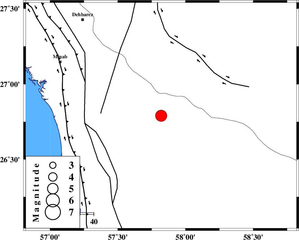
| Location | Lat:26.79 Lon: 57.82 |
| Region | Hormozgan Province, 76 km South-East of Manujan |
Nearest Cities |
|
| 23 km North of Angahran, Hormozgan Province | |
| 29 km North East of Darpahn, Hormozgan Province | |
| 37 km South of Keshmiran, Kerman Province | |
| 39 km East of Sanadrak, Hormozgan Province | |
| 63 km South East of Koryan, Hormozgan Province | |
| Depth | 15 km |
| Agency | |
Faults within 150 km: |
|
| SABZEVARAN_F (Length: 190 km) , Distance to epicenter: 44 km | |
| ZENDAN_MINAB_F_Z2 (Length: 63 km) , Distance to epicenter: 48 km | |
| JIROFT_F (Length: 144 km) , Distance to epicenter: 50 km | |
| Number of Phases | 9 |
| RMS | 0.1 |
| Number of Stations | 10 |
| Error in Latitude | >2.6 km |
| Error in Longitude | 1 km |
| Error in Depth | 0 km |
Download waveform in seisan format
to download seisan software Click here
to access information about IIEES stations Click here
Amplitude | ||||||||
| UID | Agency | Station | Component | Amplitude | Period | Arrival Time | Proccessing Time | Signal Clip |
| 91700 | IIEES | MAKU | E | 464.4 | 2.04 | 2014-02-02 14:30:52 | 2014-02-02 04:19:00 | n |
Phase | ||||||||||||
| Agency | Station | Component | Phase Type | Phase Quality | First Motion | Observed Arrival Time | Time Residual | Loc. Flag | Input Weight | Distance | Azimuth | |
| IIEES | CHBR | Z | Pn | E | 2014-02-02 14:27:28 | 0.01 | y | 297 | 116 | |||
| IIEES | BSRN | Z | Pn | E | 2014-02-02 14:28:05 | -0.04 | y | 588 | 12 | |||
| IIEES | AHRM | Z | Pn | E | 2014-02-02 14:28:16 | -0.07 | y | 683 | 291 | |||
| IIEES | SHGR | Z | Pn | E | 2014-02-02 14:29:03 | 0.09 | y | 1055 | 306 | |||
| IIEES | GHVR | Z | Pn | E | 2014-02-02 14:29:03 | 0.17 | y | 1060 | 325 | |||
| IIEES | ASAO | Z | Pn | E | 2014-02-02 14:29:13 | 0.12 | y | 1139 | 321 | |||
| IIEES | CHTH | Z | Pn | E | 2014-02-02 14:29:20 | -0.07 | y | 1195 | 329 | |||
| IIEES | ZNJK | Z | Pn | E | 2014-02-02 14:29:45 | -0.1 | y | 1395 | 324 | |||
| IIEES | GRMI | Z | Pn | E | 2014-02-02 14:30:14 | 0.15 | y | 1624 | 328 | |||