
Magnitude |
2.8 |
| Date & Time (UTC) | 2014-02-06 11:28:54.5 |
| Date & Time (Local) | 1392/11/17 14:58:54.5 |
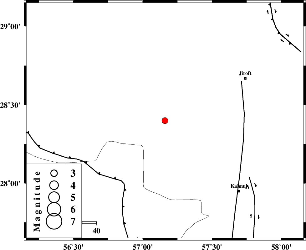
| Location | Lat:28.4 Lon: 57.16 |
| Region | Kerman Province, 64 km South-West of Jiroft |
Nearest Cities |
|
| 27 km North West of Hurpasefid, Kerman Province | |
| 28 km North East of Sarkhan, Kerman Province | |
| 36 km South of Dolatabad, Kerman Province | |
| 39 km North West of Faryab, Kerman Province | |
| 42 km North West of Mehrueye-e paeen, Kerman Province | |
| Depth | 14 km |
| Agency | |
Faults within 150 km: |
|
| MAIN_ZAGROS_R_F (Length: 1106 km) , Distance to epicenter: 53 km | |
| SABZEVARAN_F (Length: 190 km) , Distance to epicenter: 56 km | |
| JIROFT_F (Length: 144 km) , Distance to epicenter: 72 km | |
| Number of Phases | 5 |
| RMS | 0.1 |
| Number of Stations | 5 |
| Error in Latitude | >5 km |
| Error in Longitude | 7.6 km |
| Error in Depth | 6.3 km |
Download waveform in seisan format
to download seisan software Click here
to access information about IIEES stations Click here
Amplitude | ||||||||
| UID | Agency | Station | Component | Amplitude | Period | Arrival Time | Proccessing Time | Signal Clip |
| 91739 | IIEES | BNDS | N | 127 | 0.27 | 2014-02-06 11:29:33 | 2014-02-06 12:02:00 | n |
| 91740 | IIEES | KRBR | E | 111.6 | 0.19 | 2014-02-06 11:29:54 | 2014-02-06 12:02:00 | n |
Phase | ||||||||||||
| Agency | Station | Component | Phase Type | Phase Quality | First Motion | Observed Arrival Time | Time Residual | Loc. Flag | Input Weight | Distance | Azimuth | |
| IIEES | KRBR | Z | Pg | E | 2014-02-06 11:29:24 | -0.04 | y | 180 | 348 | |||
| IIEES | KRBR | N | Sg | E | 2014-02-06 11:29:46 | 0.02 | y | 180 | 348 | |||
| IIEES | ZHSF | Z | Pn | E | 2014-02-06 11:29:49 | 0.03 | y | 377 | 68 | |||
| IIEES | BSRN | Z | Pn | E | 2014-02-06 11:29:56 | -0.08 | y | 438 | 25 | |||
| IIEES | TABS | Z | Pn | E | 2014-02-06 11:30:14 | 0.1 | y | 582 | 360 | |||