
Magnitude |
4.2 |
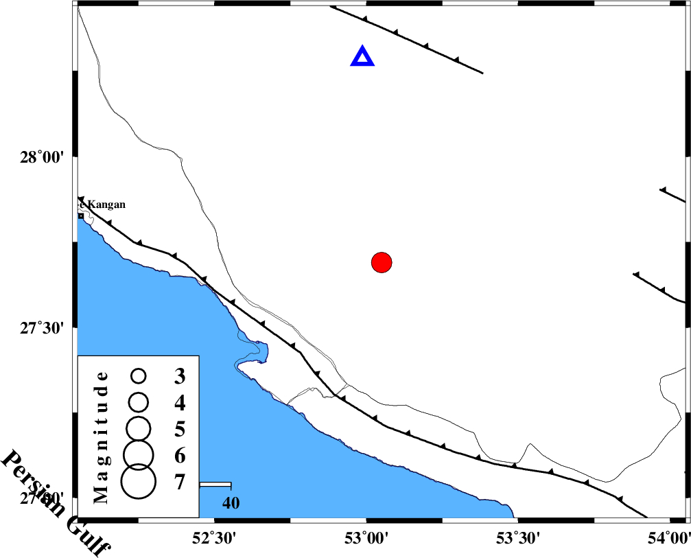
| Date & Time (UTC) | 2014-02-17 04:10:12.2 |
| Date & Time (Local) | 1392/11/28 07:40:12.2 |
| Location | Lat:27.69 Lon: 53.05 |
| Region | Fars Province, 23 km North-East of Mehr |
Nearest Cities |
|
| 12 km North of Alamarvdasht, Fars Province | |
| 23 km North East of Mehr, Fars Province | |
| 27 km North East of Ardavan-e olia, Fars Province | |
| 28 km North of Khoozi, Fars Province | |
| 37 km East of Asir, Fars Province | |
| Depth | 14 km |
| Agency | |
Faults within 150 km: |
|
| MFF3 (Length: 292 km) , Distance to epicenter: 39 km | |
| QIR_F (Length: 130 km) , Distance to epicenter: 70 km | |
| LAR_F (Length: 99 km) , Distance to epicenter: 82 km | |
| Number of Phases | 8 |
| RMS | 0.4 |
| Number of Stations | 8 |
| Error in Latitude | >9.1 km |
| Error in Longitude | 2.6 km |
| Error in Depth | 0 km |
Download waveform in seisan format
to download seisan software Click here
to access information about IIEES stations Click here
Amplitude | ||||||||
| UID | Agency | Station | Component | Amplitude | Period | Arrival Time | Proccessing Time | Signal Clip |
| 91813 | IIEES | SHGR | N | 93.2 | 0.54 | 2014-02-17 04:12:53 | 2014-02-17 04:54:00 | n |
| 91814 | IIEES | SHGR | E | 108.3 | 0.54 | 2014-02-17 04:13:03 | 2014-02-17 04:54:00 | n |
Phase | ||||||||||||
| Agency | Station | Component | Phase Type | Phase Quality | First Motion | Observed Arrival Time | Time Residual | Loc. Flag | Input Weight | Distance | Azimuth | |
| IIEES | AHRM | Z | Pn | E | 2014-02-17 04:10:47 | 0.35 | y | 216 | 308 | |||
| IIEES | YZKH | Z | Pn | E | 2014-02-17 04:11:27 | 0.29 | y | 542 | 16 | |||
| IIEES | SHGR | Z | Pn | E | 2014-02-17 04:11:38 | -0.96 | y | 639 | 321 | |||
| IIEES | BSRN | Z | Pn | E | 2014-02-17 04:11:53 | -0.05 | y | 754 | 50 | |||
| IIEES | CHBR | Z | Pn | E | 2014-02-17 04:11:56 | 0 | y | 775 | 106 | |||
| IIEES | ZHSF | Z | Pn | E | 2014-02-17 04:11:57 | -0.08 | y | 784 | 72 | |||
| IIEES | SHRT | Z | Pn | E | 2014-02-17 04:12:18 | -0.13 | y | 957 | 45 | |||
| IIEES | ZNJK | Z | Pn | E | 2014-02-17 04:12:34 | 0.3 | y | 1078 | 339 | |||