
Magnitude |
2.5 |
| Date & Time (UTC) | 2014-02-24 17:13:59.0 |
| Date & Time (Local) | 1392/12/5 20:43:59.0 |
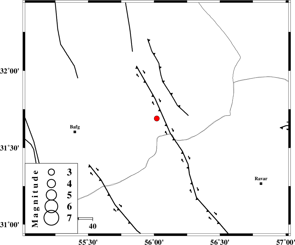
| Location | Lat:31.69 Lon: 56.02 |
| Region | Yazd Province, 59 km East of Bafq |
Nearest Cities |
|
| 8 km of Benestan, Yazd Province | |
| 20 km North West of Asfih, Yazd Province | |
| 20 km South of Behabad, Yazd Province | |
| 23 km East of Kushk, Yazd Province | |
| 24 km North of Basab, Yazd Province | |
| Depth | 15 km |
| Agency | |
Faults within 150 km: |
|
| KUHBANAN_F (Length: 189 km) , Distance to epicenter: 14 km | |
| JAFARABAD_F (Length: 60 km) , Distance to epicenter: 18 km | |
| SARBALA_F (Length: 92 km) , Distance to epicenter: 51 km | |
| Number of Phases | 3 |
| RMS | 0 |
| Number of Stations | 3 |
| Error in Latitude | >1.6 km |
| Error in Longitude | 2.4 km |
| Error in Depth | 0 km |
Download waveform in seisan format
to download seisan software Click here
to access information about IIEES stations Click here
Amplitude | ||||||||
| UID | Agency | Station | Component | Amplitude | Period | Arrival Time | Proccessing Time | Signal Clip |
| 91879 | IIEES | KRBR | N | 41.1 | 0.48 | 2014-02-24 17:14:59 | 2014-02-24 06:42:00 | n |
| 91880 | IIEES | KRBR | E | 44 | 0.28 | 2014-02-24 17:14:59 | 2014-02-24 06:42:00 | n |
Phase | ||||||||||||
| Agency | Station | Component | Phase Type | Phase Quality | First Motion | Observed Arrival Time | Time Residual | Loc. Flag | Input Weight | Distance | Azimuth | |
| IIEES | YZKH | Z | Pg | E | 2014-02-24 17:14:24 | 0 | y | 156 | 300 | |||
| IIEES | KRBR | Z | Pg | E | 2014-02-24 17:14:32 | 0 | y | 202 | 159 | |||
| IIEES | TABS | N | Pn | E | 2014-02-24 17:14:36 | 0 | y | 241 | 25 | |||