
Magnitude |
1.9 |
| Date & Time (UTC) | 2014-02-27 14:08:41.7 |
| Date & Time (Local) | 1392/12/8 17:38:41.7 |
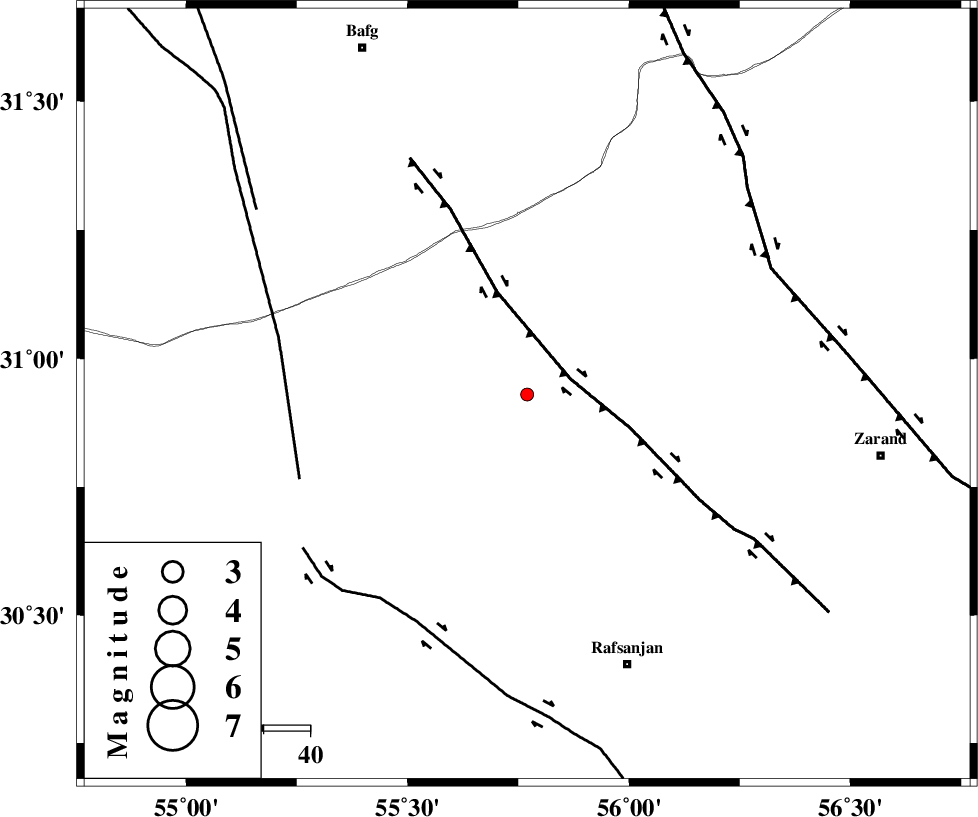
| Location | Lat:30.93 Lon: 55.77 |
| Region | Kerman Province, 63 km North-West of Rafsanjan |
Nearest Cities |
|
| 7 km North of Bahreman, Kerman Province | |
| 10 km North East of Esmaeelabad, Kerman Province | |
| 13 km North of Ferdosiyeh, Kerman Province | |
| 22 km West of Seyriz, Kerman Province | |
| 41 km North East of Hoseiynabad-e amin, Kerman Province | |
| Depth | 15 km |
| Agency | |
Faults within 150 km: |
|
| DARIVAN_F (Length: 131 km) , Distance to epicenter: 10 km | |
| ANAR_F (Length: 127 km) , Distance to epicenter: 52 km | |
| RAFSANJAN_F (Length: 129 km) , Distance to epicenter: 54 km | |
| Number of Phases | 4 |
| RMS | 0.5 |
| Number of Stations | 4 |
| Error in Latitude | >7.5 km |
| Error in Longitude | 5 km |
| Error in Depth | 0 km |
Download waveform in seisan format
to download seisan software Click here
to access information about IIEES stations Click here
Amplitude | ||||||||
| UID | Agency | Station | Component | Amplitude | Period | Arrival Time | Proccessing Time | Signal Clip |
| 91890 | IIEES | KRBR | N | 19.4 | 0.4 | 2014-02-27 14:09:30 | 2014-02-28 03:20:00 | n |
| 91891 | IIEES | KRBR | E | 28.7 | 0.48 | 2014-02-27 14:09:32 | 2014-02-28 03:20:00 | n |
Phase | ||||||||||||
| Agency | Station | Component | Phase Type | Phase Quality | First Motion | Observed Arrival Time | Time Residual | Loc. Flag | Input Weight | Distance | Azimuth | |
| IIEES | KRBR | Z | Pn | E | 2014-02-27 14:09:07 | 0.23 | y | 142 | 138 | |||
| IIEES | YZKH | Z | Pn | E | 2014-02-27 14:09:13 | -0.29 | y | 196 | 326 | |||
| IIEES | TABS | Z | Pn | E | 2014-02-27 14:09:30 | 0.75 | y | 327 | 23 | |||
| IIEES | BSRN | Z | Pn | E | 2014-02-27 14:09:30 | -0.7 | y | 339 | 69 | |||