
Magnitude |
4.3 |
| Date & Time (UTC) | 2014-03-12 20:22:00.5 |
| Date & Time (Local) | 1392/12/21 23:52:00.5 |
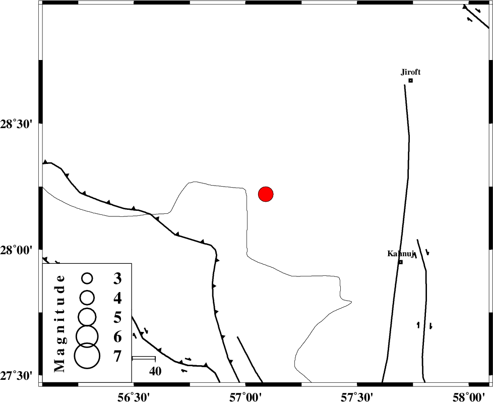
| Location | Lat:28.22 Lon: 57.09 |
| Region | Kerman Province, 67 km North-West of Kahnuj |
Nearest Cities |
|
| 22 km North West of Hurpasefid, Kerman Province | |
| 25 km North West of Faryab, Kerman Province | |
| 25 km South East of Sarkhan, Kerman Province | |
| 34 km North West of Mehrueye-e paeen, Kerman Province | |
| 45 km North West of Bolock, Kerman Province | |
| Depth | 14 km |
| Agency | |
Faults within 150 km: |
|
| MAIN_ZAGROS_R_F (Length: 1106 km) , Distance to epicenter: 33 km | |
| SABZEVARAN_F (Length: 190 km) , Distance to epicenter: 63 km | |
| ZENDAN_MINAB_F_Z1 (Length: 183 km) , Distance to epicenter: 64 km | |
| Number of Phases | 7 |
| RMS | 0.2 |
| Number of Stations | 6 |
| Error in Latitude | >4.3 km |
| Error in Longitude | 7.2 km |
| Error in Depth | 8.1 km |
Download waveform in seisan format
to download seisan software Click here
to access information about IIEES stations Click here
Amplitude | ||||||||
| UID | Agency | Station | Component | Amplitude | Period | Arrival Time | Proccessing Time | Signal Clip |
| 91981 | IIEES | KRBR | E | 2402.7 | 0.56 | 2014-03-12 20:23:05 | 2014-03-12 09:01:00 | n |
| 91982 | IIEES | KRBR | N | 4192.4 | 0.84 | 2014-03-12 20:23:06 | 2014-03-12 09:01:00 | n |
Phase | ||||||||||||
| Agency | Station | Component | Phase Type | Phase Quality | First Motion | Observed Arrival Time | Time Residual | Loc. Flag | Input Weight | Distance | Azimuth | |
| IIEES | KRBR | Z | Pn | E | 2014-03-12 20:22:33 | 0.32 | y | 198 | 351 | |||
| IIEES | KRBR | E | Sg | E | 2014-03-12 20:22:56 | -0.07 | y | 198 | 351 | |||
| IIEES | CHBR | Z | Pn | E | 2014-03-12 20:23:03 | -0.09 | y | 445 | 130 | |||
| IIEES | BSRN | Z | Pn | E | 2014-03-12 20:23:05 | -0.03 | y | 459 | 25 | |||
| IIEES | YZKH | Z | Pn | E | 2014-03-12 20:23:12 | -0.28 | y | 521 | 333 | |||
| IIEES | TABS | Z | Pn | E | 2014-03-12 20:23:23 | 0.05 | y | 602 | 0 | |||
| IIEES | SHRT | Z | Pn | E | 2014-03-12 20:23:31 | -0.01 | y | 675 | 26 | |||