
Magnitude |
3.5 |
| Date & Time (UTC) | 2014-04-18 20:43:55.0 |
| Date & Time (Local) | 1393/1/30 01:13:55.0 |
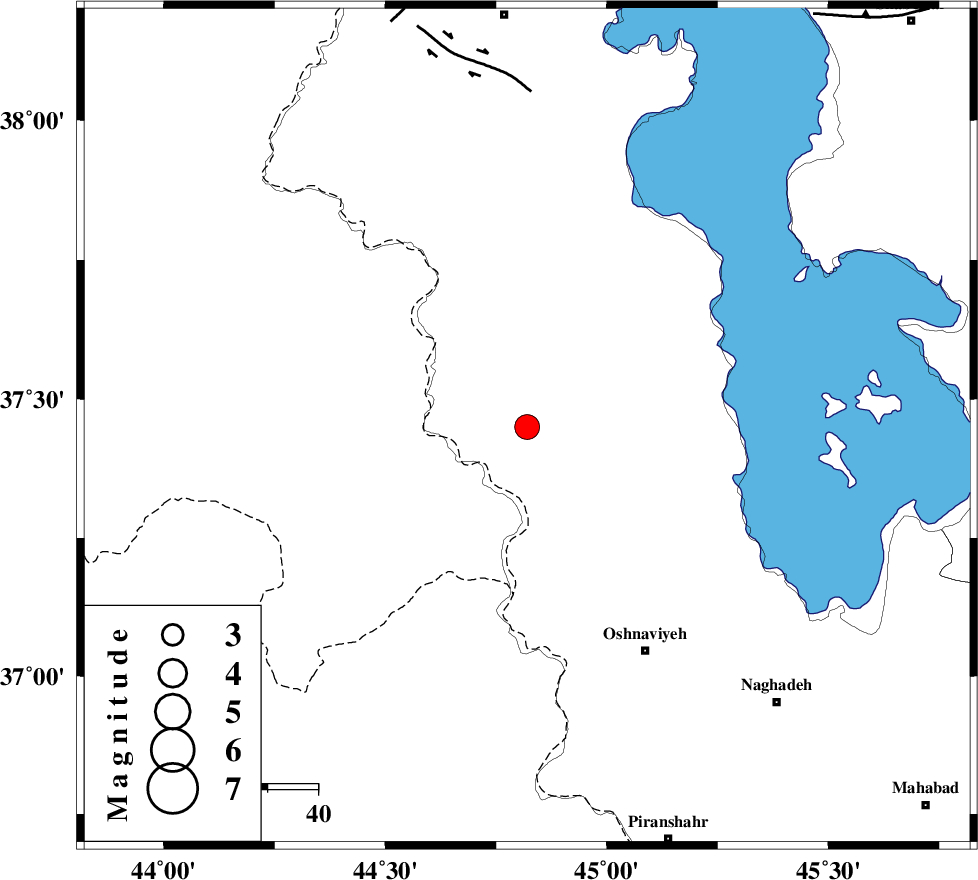
| Location | Lat:37.45 Lon: 44.82 |
| Region | Azarbaijan Gharbi Province, 24 km South-West of Orumiyeh |
Nearest Cities |
|
| 4 km North of Silvaneh, Azarbaijan Gharbi Province | |
| 8 km North of Razhan, Azarbaijan Gharbi Province | |
| 14 km South of Movana, Azarbaijan Gharbi Province | |
| 24 km South West of Orumiyeh, Azarbaijan Gharbi Province | |
| 25 km North West of Baranduz, Azarbaijan Gharbi Province | |
| Depth | 17 km |
| Agency | |
Faults within 150 km: |
|
| SALMAS (Length: 20 km) , Distance to epicenter: 67 km | |
| PIRANSHAHR_F (Length: 253 km) , Distance to epicenter: 86 km | |
| N_TABRIZ_F3 (Length: 66 km) , Distance to epicenter: 91 km | |
| Number of Phases | 6 |
| RMS | 0.1 |
| Number of Stations | 5 |
| Error in Latitude | >2 km |
| Error in Longitude | 3.5 km |
| Error in Depth | 3.5 km |
Download waveform in seisan format
to download seisan software Click here
to access information about IIEES stations Click here
Amplitude | ||||||||
| UID | Agency | Station | Component | Amplitude | Period | Arrival Time | Proccessing Time | Signal Clip |
| 92245 | IIEES | SNGE | N | 70.6 | 0.56 | 2014-04-18 20:45:44 | 2014-04-18 10:10:00 | n |
| 92246 | IIEES | SHGR | N | 28.5 | 0.64 | 2014-04-18 20:46:28 | 2014-04-18 10:10:00 | n |
Phase | ||||||||||||
| Agency | Station | Component | Phase Type | Phase Quality | First Motion | Observed Arrival Time | Time Residual | Loc. Flag | Input Weight | Distance | Azimuth | |
| IIEES | MAKU | Z | Pg | E | 2014-04-18 20:44:29 | 0 | y | 212 | 357 | |||
| IIEES | GRMI | Z | Pn | E | 2014-04-18 20:44:40 | -0.01 | y | 309 | 60 | |||
| IIEES | SNGE | Z | Pn | E | 2014-04-18 20:44:45 | 0.19 | y | 346 | 138 | |||
| IIEES | SNGE | N | Sg | E | 2014-04-18 20:45:32 | -0.09 | y | 346 | 138 | |||
| IIEES | ZNJK | Z | Pn | E | 2014-04-18 20:44:46 | -0.18 | y | 354 | 103 | |||
| IIEES | ZNJK | N | Sg | E | 2014-04-18 20:45:34 | 0.09 | y | 354 | 103 | |||