
Magnitude |
4.3 |
| Date & Time (UTC) | 2014-04-25 11:57:00.3 |
| Date & Time (Local) | 1393/2/5 16:27:00.3 |
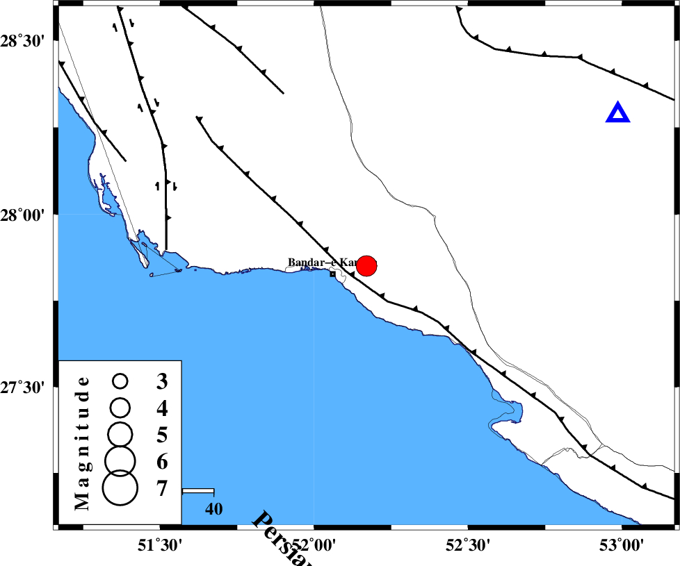
| Location | Lat:27.85 Lon: 52.17 |
| Region | Bushehr Province, 11 km East of Bandar-e kangan |
Nearest Cities |
|
| 11 km North East of Bandar-e kangan, Bushehr Province | |
| 14 km North West of Jam, Bushehr Province | |
| 24 km South of Riz, Bushehr Province | |
| 27 km North West of Bandar-e taheri, Bushehr Province | |
| 35 km South West of Dolatabad, Fars Province | |
| Depth | 24 km |
| Agency | |
Faults within 150 km: |
|
| MFF3 (Length: 292 km) , Distance to epicenter: 7 km | |
| MFF5 (Length: 74 km) , Distance to epicenter: 61 km | |
| BORAZJAN_F (Length: 168 km) , Distance to epicenter: 64 km | |
| Number of Phases | 7 |
| RMS | 0.1 |
| Number of Stations | 7 |
| Error in Latitude | >3.4 km |
| Error in Longitude | 1.5 km |
| Error in Depth | 3.6 km |
Download waveform in seisan format
to download seisan software Click here
to access information about IIEES stations Click here
Amplitude | ||||||||
| UID | Agency | Station | Component | Amplitude | Period | Arrival Time | Proccessing Time | Signal Clip |
| 92269 | IIEES | CHBR | N | 27.3 | 0.36 | 2014-04-25 12:00:21 | 2014-04-25 01:23:00 | n |
| 92270 | IIEES | SNGE | N | 30.4 | 0.56 | 2014-04-25 12:00:43 | 2014-04-25 01:23:00 | n |
Phase | ||||||||||||
| Agency | Station | Component | Phase Type | Phase Quality | First Motion | Observed Arrival Time | Time Residual | Loc. Flag | Input Weight | Distance | Azimuth | |
| IIEES | GHIR | Z | Pg | E | 2014-04-25 11:57:16 | 0.02 | y | 94 | 59 | |||
| IIEES | GHIR | E | Sg | E | 2014-04-25 11:57:27 | -0.02 | y | 94 | 59 | |||
| IIEES | AHRM | Z | Pg | E | 2014-04-25 11:57:23 | 0.09 | y | 141 | 323 | |||
| IIEES | AHRM | N | Sg | E | 2014-04-25 11:57:40 | -0.09 | y | 141 | 323 | |||
| IIEES | BNDS | Z | Pn | E | 2014-04-25 11:57:56 | -0.13 | y | 398 | 96 | |||
| IIEES | KRBR | Z | Pn | E | 2014-04-25 11:58:10 | 0.12 | y | 507 | 61 | |||
| IIEES | YZKH | Z | Pn | E | 2014-04-25 11:58:16 | 0.02 | y | 555 | 24 | |||