
Magnitude |
3.9 |
| Date & Time (UTC) | 2014-04-24 07:44:29.3 |
| Date & Time (Local) | 1393/2/4 12:14:29.3 |
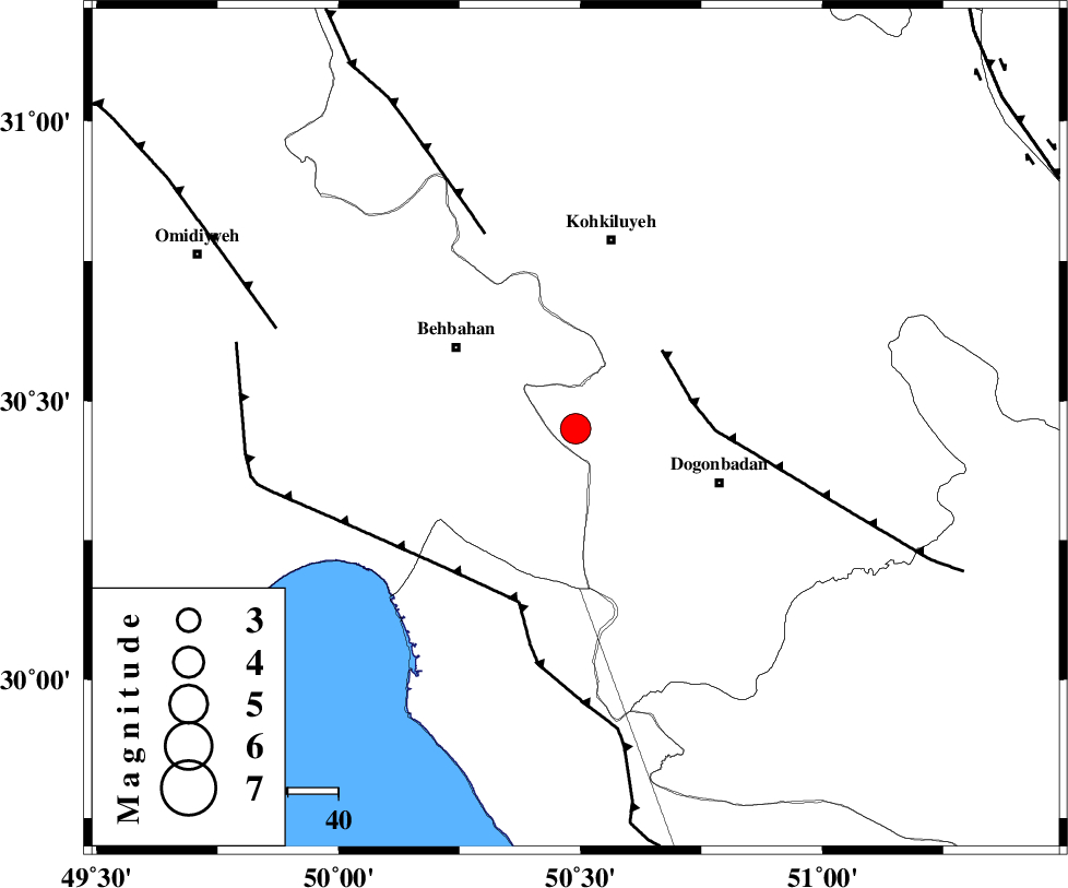
| Location | Lat:30.45 Lon: 50.49 |
| Region | Kohkiluieh va boyerahmad Province, 28 km South-East of Behbahan |
Nearest Cities |
|
| 27 km South East of Mansuriyeh, Khoozestan Province | |
| 29 km South East of Behbahan, Khoozestan Province | |
| 30 km North East of Sardasht, Khoozestan Province | |
| 30 km North West of Dogonbadan, Kohkiluieh va boyerahmad Province | |
| 38 km South of Dehdasht, Kohkiluieh va boyerahmad Province | |
| Depth | 18 km |
| Agency | |
Faults within 150 km: |
|
| MISHAN_F (Length: 76 km) , Distance to epicenter: 23 km | |
| ZFF3 (Length: 125 km) , Distance to epicenter: 36 km | |
| RAG_E_SEFID_F (Length: 84 km) , Distance to epicenter: 36 km | |
| Number of Phases | 5 |
| RMS | 0.2 |
| Number of Stations | 4 |
| Error in Latitude | >4 km |
| Error in Longitude | 5.8 km |
| Error in Depth | 6.4 km |
Download waveform in seisan format
to download seisan software Click here
to access information about IIEES stations Click here
Amplitude | ||||||||
| UID | Agency | Station | Component | Amplitude | Period | Arrival Time | Proccessing Time | Signal Clip |
| 92280 | IIEES | AHRM | N | 1109.2 | 0.51 | 2014-04-24 07:45:26 | 2014-04-26 12:21:00 | n |
| 92281 | IIEES | SHGR | E | 955.9 | 0.49 | 2014-04-24 07:45:51 | 2014-04-26 12:21:00 | n |
| 92282 | IIEES | SHGR | N | 909.7 | 0.68 | 2014-04-24 07:45:54 | 2014-04-26 12:21:00 | n |
| 92283 | IIEES | GHIR | E | 290.2 | 0.42 | 2014-04-24 07:46:20 | 2014-04-26 12:21:00 | n |
Phase | ||||||||||||
| Agency | Station | Component | Phase Type | Phase Quality | First Motion | Observed Arrival Time | Time Residual | Loc. Flag | Input Weight | Distance | Azimuth | |
| IIEES | AHRM | Z | Pg | E | 2014-04-24 07:45:01 | 0.22 | y | 193 | 156 | |||
| IIEES | SHGR | Z | Pn | E | 2014-04-24 07:45:06 | -0.06 | y | 244 | 319 | |||
| IIEES | SHGR | N | Sg | E | 2014-04-24 07:45:38 | 0.02 | y | 244 | 319 | |||
| IIEES | GHIR | Z | Pn | E | 2014-04-24 07:45:18 | -0.34 | y | 341 | 134 | |||
| IIEES | YZKH | Z | P | E | 2014-04-24 07:45:32 | 0.15 | y | 445 | 60 | |||