
Magnitude |
2.9 |
| Date & Time (UTC) | 2014-05-03 22:49:52.7 |
| Date & Time (Local) | 1393/2/14 03:19:52.7 |
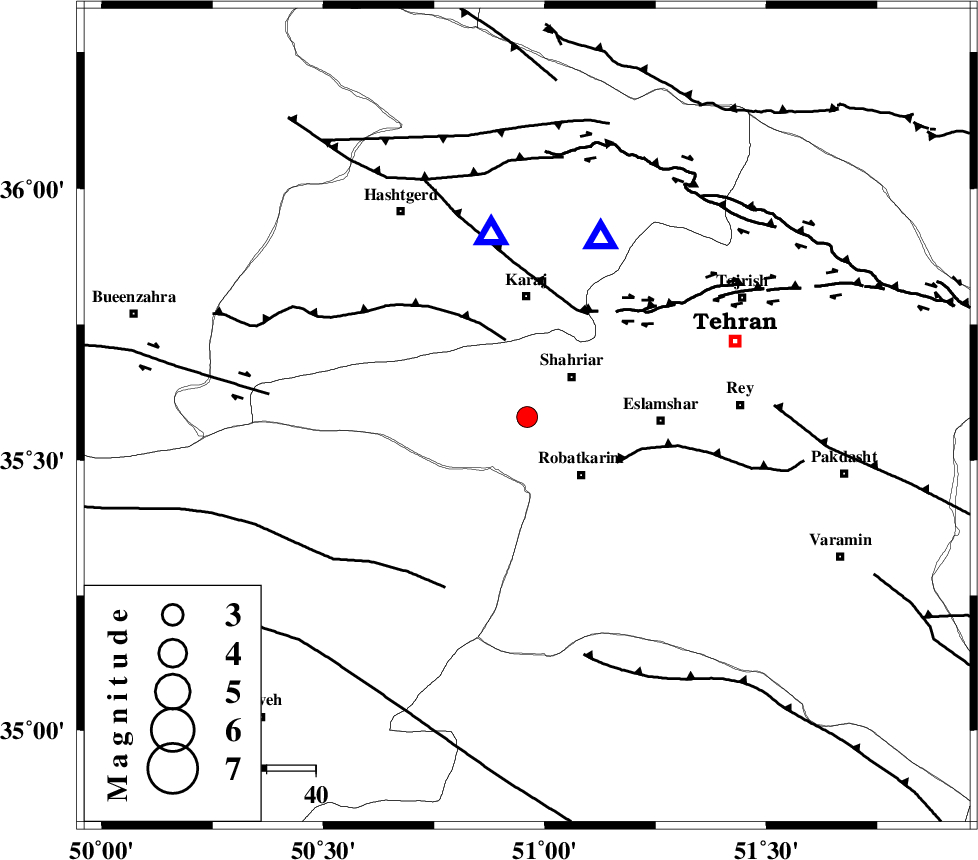
| Location | Lat:35.58 Lon: 50.96 |
| Region | Tehran Province, 13 km West of Shahriyar |
Nearest Cities |
|
| 7 km of Joqin, Tehran Province | |
| 9 km of Malard, Tehran Province | |
| 10 km North of Manjilabad, Tehran Province | |
| 12 km West of Shahriyar, Tehran Province | |
| 16 km North West of Robatkarim, Tehran Province | |
| Depth | 14 km |
| Agency | |
Faults within 150 km: |
|
| ESHTEHARD_F (Length: 69 km) , Distance to epicenter: 16 km | |
| KAHRIZAK_F (Length: 44 km) , Distance to epicenter: 21 km | |
| N_TEHRAN_F4 (Length: 115 km) , Distance to epicenter: 24 km | |
| Number of Phases | 5 |
| RMS | 0.1 |
| Number of Stations | 5 |
| Error in Latitude | >2.3 km |
| Error in Longitude | 2.7 km |
| Error in Depth | 4.8 km |
Download waveform in seisan format
to download seisan software Click here
to access information about IIEES stations Click here
Amplitude | ||||||||
| UID | Agency | Station | Component | Amplitude | Period | Arrival Time | Proccessing Time | Signal Clip |
| 92334 | IIEES | DAMV | E | 313 | 0.2 | 2014-05-03 22:50:20 | 2014-05-04 12:45:00 | n |
| 92335 | IIEES | GHVR | E | 356.1 | 0.24 | 2014-05-03 22:50:30 | 2014-05-04 12:45:00 | n |
Phase | ||||||||||||
| Agency | Station | Component | Phase Type | Phase Quality | First Motion | Observed Arrival Time | Time Residual | Loc. Flag | Input Weight | Distance | Azimuth | |
| IIEES | DAMV | Z | Pg | E | 2014-05-03 22:50:08 | -0.04 | y | 91.9 | 86 | |||
| IIEES | GHVR | Z | Pg | E | 2014-05-03 22:50:13 | 0.12 | y | 124 | 168 | |||
| IIEES | ASAO | Z | Pg | E | 2014-05-03 22:50:16 | -0.14 | y | 142 | 217 | |||
| IIEES | KHMZ | Z | Pn | E | 2014-05-03 22:50:28 | 0.03 | y | 223 | 204 | |||
| IIEES | ZNJK | Z | Pn | E | 2014-05-03 22:50:30 | 0.03 | y | 238 | 301 | |||