
Magnitude |
2.7 |
| Date & Time (UTC) | 2014-05-12 04:00:16.4 |
| Date & Time (Local) | 1393/2/22 08:30:16.4 |
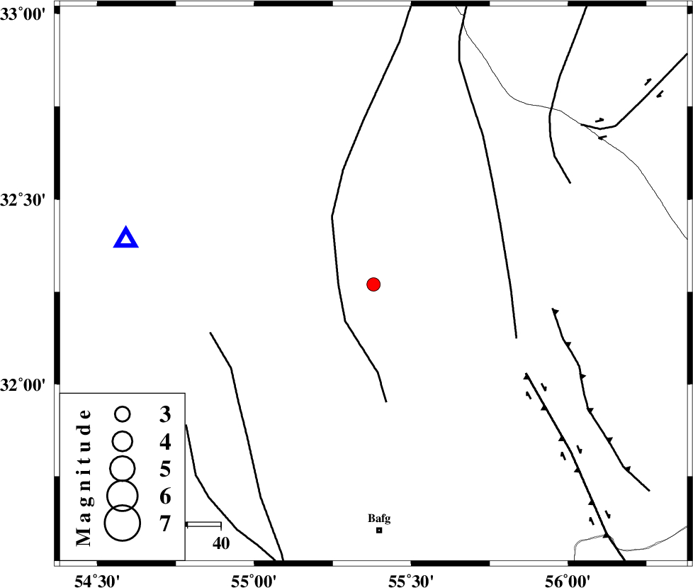
| Location | Lat:32.27 Lon: 55.38 |
| Region | Yazd Province, 75 km North of Bafq |
Nearest Cities |
|
| 68 km East of Kharaneq, Yazd Province | |
| 70 km North West of Kushk, Yazd Province | |
| 72 km North of Mobarake, Yazd Province | |
| 74 km North of Bafq, Yazd Province | |
| 75 km North West of Behabad, Yazd Province | |
| Depth | 14 km |
| Agency | |
Faults within 150 km: |
|
| POSHT_E_BADAM_F (Length: 128 km) , Distance to epicenter: 11 km | |
| SARBALA_F (Length: 92 km) , Distance to epicenter: 41 km | |
| ANAR_F (Length: 91 km) , Distance to epicenter: 50 km | |
| Number of Phases | 7 |
| RMS | 0.3 |
| Number of Stations | 4 |
| Error in Latitude | >2.5 km |
| Error in Longitude | 8.9 km |
| Error in Depth | 9.9 km |
Download waveform in seisan format
to download seisan software Click here
to access information about IIEES stations Click here
Amplitude | ||||||||
| UID | Agency | Station | Component | Amplitude | Period | Arrival Time | Proccessing Time | Signal Clip |
| 92405 | IIEES | TABS | N | 54.8 | 0.53 | 2014-05-12 04:01:24 | 2014-05-12 05:28:00 | n |
Phase | ||||||||||||
| Agency | Station | Component | Phase Type | Phase Quality | First Motion | Observed Arrival Time | Time Residual | Loc. Flag | Input Weight | Distance | Azimuth | |
| IIEES | TABS | Z | Pn | E | 2014-05-12 04:00:51 | -0.02 | y | 223 | 46 | |||
| IIEES | TABS | E | Sg | E | 2014-05-12 04:01:19 | -0.36 | y | 223 | 46 | |||
| IIEES | KRBR | Z | Pn | E | 2014-05-12 04:00:59 | -0.09 | y | 286 | 152 | |||
| IIEES | KRBR | N | Sg | E | 2014-05-12 04:01:37 | -0.2 | y | 286 | 152 | |||
| IIEES | BSRN | Z | Pn | E | 2014-05-12 04:01:08 | 0.06 | y | 355 | 95 | |||
| IIEES | BSRN | E | Sg | E | 2014-05-12 04:01:56 | 0.27 | y | 355 | 95 | |||
| IIEES | SHRT | Z | Pn | E | 2014-05-12 04:01:24 | 0.55 | y | 484 | 70 | |||