
Magnitude |
3.4 |
| Date & Time (UTC) | 2014-05-12 20:45:21.1 |
| Date & Time (Local) | 1393/2/23 01:15:21.1 |
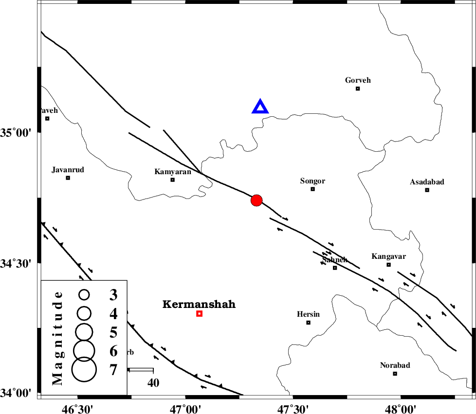
| Location | Lat:34.74 Lon: 47.33 |
| Region | Kermanshah Province, 25 km West of Sonqor |
Nearest Cities |
|
| 5 km North of Mueeneh, Kermanshah Province | |
| 14 km North of Kanduleh, Kermanshah Province | |
| 14 km South of Shirkuh, Kermanshah Province | |
| 17 km East of Kiunan, Kermanshah Province | |
| 18 km North West of Gaznahleh, Kermanshah Province | |
| Depth | 18 km |
| Agency | |
Faults within 150 km: |
|
| SARTAKHT_F (Length: 78 km) , Distance to epicenter: 1 km | |
| DINEHVAR_F (Length: 46 km) , Distance to epicenter: 9 km | |
| MORVARID_F (Length: 24 km) , Distance to epicenter: 26 km | |
| Number of Phases | 8 |
| RMS | 0.2 |
| Number of Stations | 6 |
| Error in Latitude | >2.6 km |
| Error in Longitude | 7.8 km |
| Error in Depth | 9 km |
Download waveform in seisan format
to download seisan software Click here
to access information about IIEES stations Click here
Amplitude | ||||||||
| UID | Agency | Station | Component | Amplitude | Period | Arrival Time | Proccessing Time | Signal Clip |
| 92415 | IIEES | ZNJK | E | 221.3 | 0.84 | 2014-05-12 20:46:33 | 2014-05-12 10:16:00 | n |
Phase | ||||||||||||
| Agency | Station | Component | Phase Type | Phase Quality | First Motion | Observed Arrival Time | Time Residual | Loc. Flag | Input Weight | Distance | Azimuth | |
| IIEES | ZNJK | Z | Pn | E | 2014-05-12 20:45:59 | 0.12 | y | 247 | 30 | |||
| IIEES | ZNJK | N | Sg | E | 2014-05-12 20:46:30 | -0.09 | y | 247 | 30 | |||
| IIEES | ASAO | Z | Pn | E | 2014-05-12 20:45:59 | -0.14 | y | 248 | 94 | |||
| IIEES | KHMZ | Z | Pn | E | 2014-05-12 20:46:01 | -0.38 | y | 267 | 114 | |||
| IIEES | KHMZ | E | Sg | E | 2014-05-12 20:46:36 | 0.19 | y | 267 | 114 | |||
| IIEES | SHGR | Z | Pn | E | 2014-05-12 20:46:08 | 0.21 | y | 323 | 154 | |||
| IIEES | GHVR | Z | Pn | E | 2014-05-12 20:46:13 | -0.06 | y | 361 | 94 | |||
| IIEES | GRMI | Z | Pn | E | 2014-05-12 20:46:25 | 0.21 | y | 454 | 6 | |||