
Magnitude |
4.3 |
| Date & Time (UTC) | 2014-06-13 09:12:25.2 |
| Date & Time (Local) | 1393/3/23 13:42:25.2 |
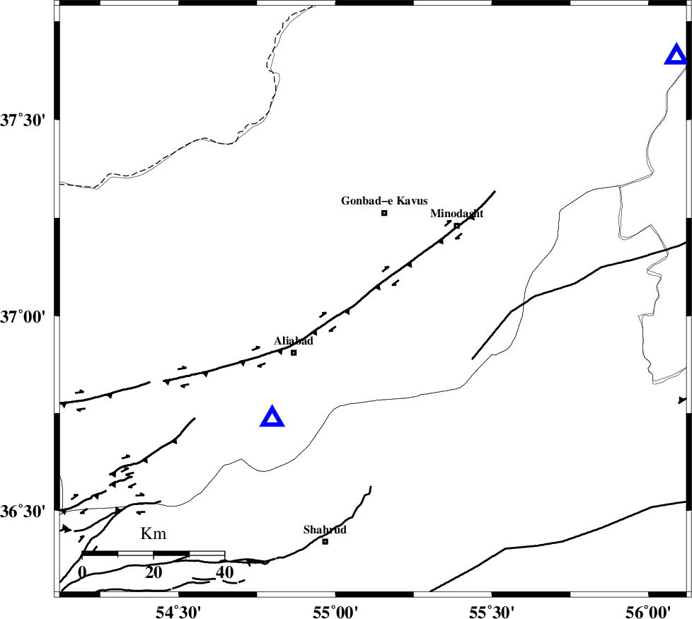
| Location | Lat:37.04 Lon: 55.12 |
| Region | Golestan Province, 4 km Ramian |
Nearest Cities |
|
| 4 km North of Ramian, Golestan Province | |
| 5 km North of Deland, Golestan Province | |
| 7 km of Azadshahr, Golestan Province | |
| 8 km of Khanduz, Golestan Province | |
| 11 km of Nezamabad, Golestan Province | |
| Depth | 14 km |
| Agency | |
Faults within 150 km: |
|
| KHAZAR_F (Length: 523 km) , Distance to epicenter: 14 km | |
| SHAVAR_F (Length: 87 km) , Distance to epicenter: 31 km | |
| ROBATE_QARABIL_F (Length: 168 km) , Distance to epicenter: 33 km | |
| Number of Phases | 9 |
| RMS | 0.2 |
| Number of Stations | 8 |
| Error in Latitude | >5.1 km |
| Error in Longitude | 2.6 km |
| Error in Depth | 6 km |
Download waveform in seisan format
to download seisan software Click here
to access information about IIEES stations Click here
Amplitude | ||||||||
| UID | Agency | Station | Component | Amplitude | Period | Arrival Time | Proccessing Time | Signal Clip |
| 92590 | IIEES | THKV | E | 855.8 | 0.56 | 2014-06-13 09:14:16 | 2014-06-13 10:43:00 | n |
| 92591 | IIEES | THKV | N | 614.7 | 0.52 | 2014-06-13 09:14:17 | 2014-06-13 10:43:00 | n |
| 92592 | IIEES | GRMI | E | 80.7 | 0.56 | 2014-06-13 09:15:12 | 2014-06-13 10:43:00 | n |
Phase | ||||||||||||
| Agency | Station | Component | Phase Type | Phase Quality | First Motion | Observed Arrival Time | Time Residual | Loc. Flag | Input Weight | Distance | Azimuth | |
| IIEES | SHRO | Z | Pg | E | 2014-06-13 09:12:48 | 0 | y | 140 | 145 | |||
| IIEES | SHRO | E | Sg | E | 2014-06-13 09:13:05 | -0.01 | y | 140 | 145 | |||
| IIEES | TABS | Z | Pn | E | 2014-06-13 09:13:24 | -0.1 | y | 418 | 154 | |||
| IIEES | YZKH | Z | Pn | E | 2014-06-13 09:13:37 | 0.05 | y | 518 | 185 | |||
| IIEES | ASAO | Z | Pn | E | 2014-06-13 09:13:40 | 0.56 | y | 537 | 240 | |||
| IIEES | ASAO | N | Sg | E | 2014-06-13 09:14:54 | -0.22 | y | 537 | 240 | |||
| IIEES | SHRT | Z | Pn | E | 2014-06-13 09:13:47 | -0.08 | y | 603 | 127 | |||
| IIEES | GRMI | Z | Pn | E | 2014-06-13 09:13:55 | -0.28 | y | 664 | 289 | |||
| IIEES | BSRN | Z | Pn | E | 2014-06-13 09:13:56 | 0.02 | y | 673 | 146 | |||