
Magnitude |
2.5 |
| Date & Time (UTC) | 2014-06-14 15:15:48.4 |
| Date & Time (Local) | 1393/3/24 19:45:48.4 |
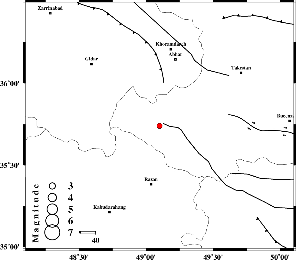
| Location | Lat:35.74 Lon: 49.1 |
| Region | Ghazvin Province, 40 km North of Razan |
Nearest Cities |
|
| 17 km West of Ab-e garm, Ghazvin Province | |
| 21 km North West of Avaj, Ghazvin Province | |
| 29 km West of Hoseynabad, Ghazvin Province | |
| 34 km South West of Darsajin, Zanjan Province | |
| 36 km North West of Kolanjin, Ghazvin Province | |
| Depth | 16 km |
| Agency | |
Faults within 150 km: |
|
| KUSHK_E_NOSRAT_F (Length: 230 km) , Distance to epicenter: 3 km | |
| SOLTANIYEH_F (Length: 119 km) , Distance to epicenter: 29 km | |
| IPAK_F (Length: 80 km) , Distance to epicenter: 47 km | |
| Number of Phases | 6 |
| RMS | 0 |
| Number of Stations | 5 |
| Error in Latitude | >1.9 km |
| Error in Longitude | 4.9 km |
| Error in Depth | 2.6 km |
Download waveform in seisan format
to download seisan software Click here
to access information about IIEES stations Click here
Amplitude | ||||||||
| UID | Agency | Station | Component | Amplitude | Period | Arrival Time | Proccessing Time | Signal Clip |
| 92599 | IIEES | THKV | E | 75 | 0.36 | 2014-06-14 15:16:27 | 2014-06-14 04:49:00 | n |
| 92600 | IIEES | THKV | N | 67.9 | 0.64 | 2014-06-14 15:16:35 | 2014-06-14 04:49:00 | n |
Phase | ||||||||||||
| Agency | Station | Component | Phase Type | Phase Quality | First Motion | Observed Arrival Time | Time Residual | Loc. Flag | Input Weight | Distance | Azimuth | |
| IIEES | ZNJK | Z | Pg | E | 2014-06-14 15:16:07 | 0.01 | y | 110 | 340 | |||
| IIEES | ASAO | Z | Pg | E | 2014-06-14 15:16:14 | -0.04 | y | 157 | 147 | |||
| IIEES | ASAO | N | Sg | E | 2014-06-14 15:16:33 | 0.04 | y | 157 | 147 | |||
| IIEES | KHMZ | Z | Pn | E | 2014-06-14 15:16:25 | 0.01 | y | 236 | 160 | |||
| IIEES | KHMZ | N | Sg | E | 2014-06-14 15:16:55 | -0.01 | y | 236 | 160 | |||
| IIEES | GHVR | Z | Pn | E | 2014-06-14 15:16:25 | -0.01 | y | 240 | 125 | |||