
Magnitude |
3.6 |
| Date & Time (UTC) | 2014-07-02 19:57:43.1 |
| Date & Time (Local) | 1393/4/12 00:27:43.1 |
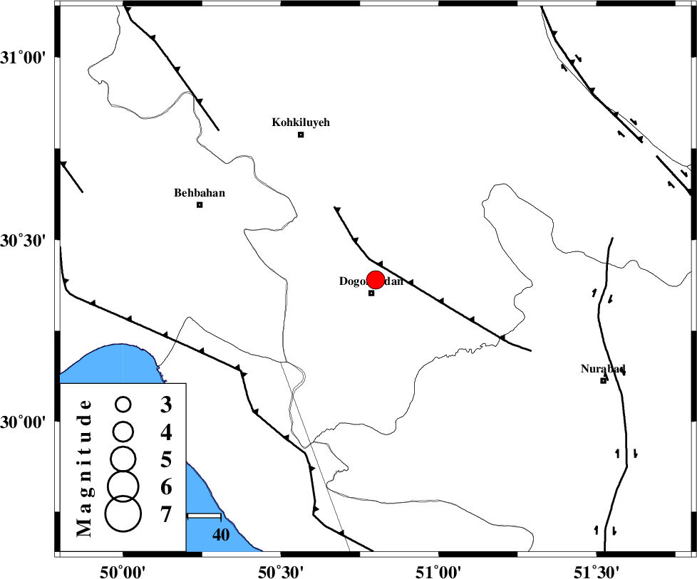
| Location | Lat:30.39 Lon: 50.8 |
| Region | Kohkiluieh va boyerahmad Province, 4 km Dogonbadan |
Nearest Cities |
|
| 4 km North of Dogonbadan, Kohkiluieh va boyerahmad Province | |
| 25 km West of Abdehgah, Kohkiluieh va boyerahmad Province | |
| 35 km North West of Basht, Kohkiluieh va boyerahmad Province | |
| 48 km North West of Kopon olia, Fars Province | |
| 50 km South East of Dehdasht, Kohkiluieh va boyerahmad Province | |
| Depth | 18 km |
| Agency | |
Faults within 150 km: |
|
| MISHAN_F (Length: 76 km) , Distance to epicenter: 5 km | |
| ZFF3 (Length: 125 km) , Distance to epicenter: 50 km | |
| RAG_E_SEFID_F (Length: 84 km) , Distance to epicenter: 50 km | |
| Number of Phases | 7 |
| RMS | 0.1 |
| Number of Stations | 5 |
| Error in Latitude | >1.6 km |
| Error in Longitude | 2.8 km |
| Error in Depth | 3.8 km |
Download waveform in seisan format
to download seisan software Click here
to access information about IIEES stations Click here
Amplitude | ||||||||
| UID | Agency | Station | Component | Amplitude | Period | Arrival Time | Proccessing Time | Signal Clip |
| 92722 | IIEES | SHGR | E | 284.2 | 0.68 | 2014-07-02 19:59:15 | 2014-07-02 09:56:00 | n |
| 92723 | IIEES | SHGR | N | 252.6 | 0.64 | 2014-07-02 19:59:23 | 2014-07-02 09:56:00 | n |
| 92724 | IIEES | ASAO | N | 92.4 | 0.48 | 2014-07-02 19:59:45 | 2014-07-02 09:56:00 | n |
Phase | ||||||||||||
| Agency | Station | Component | Phase Type | Phase Quality | First Motion | Observed Arrival Time | Time Residual | Loc. Flag | Input Weight | Distance | Azimuth | |
| IIEES | AHRM | Z | Pn | E | 2014-07-02 19:58:12 | 0 | y | 175 | 164 | |||
| IIEES | SHGR | Z | Pn | E | 2014-07-02 19:58:23 | -0.1 | y | 270 | 316 | |||
| IIEES | SHGR | N | Sg | E | 2014-07-02 19:58:59 | 0.03 | y | 270 | 316 | |||
| IIEES | YZKH | Z | Pn | E | 2014-07-02 19:58:43 | 0.06 | y | 423 | 57 | |||
| IIEES | GHVR | Z | Pn | E | 2014-07-02 19:58:47 | -0.11 | y | 456 | 5 | |||
| IIEES | ASAO | Z | Pn | E | 2014-07-02 19:58:48 | 0.13 | y | 467 | 351 | |||
| IIEES | ASAO | N | S | E | 2014-07-02 19:59:36 | 0.01 | y | 467 | 351 | |||