
Magnitude |
3.2 |
| Date & Time (UTC) | 2014-07-05 22:14:08.2 |
| Date & Time (Local) | 1393/4/15 02:44:08.2 |
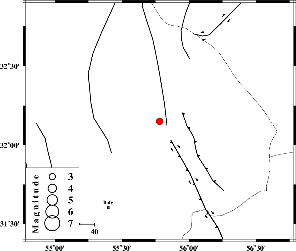
| Location | Lat:32.15 Lon: 55.78 |
| Region | Yazd Province, 71 km North-East of Bafq |
Nearest Cities |
|
| 39 km North West of Behabad, Yazd Province | |
| 46 km North of Kushk, Yazd Province | |
| 54 km North West of Benestan, Yazd Province | |
| 67 km North East of Mobarake, Yazd Province | |
| 68 km North West of Asfih, Yazd Province | |
| Depth | 17 km |
| Agency | |
Faults within 150 km: |
|
| SARBALA_F (Length: 92 km) , Distance to epicenter: 6 km | |
| KUHBANAN_F (Length: 189 km) , Distance to epicenter: 16 km | |
| JAFARABAD_F (Length: 60 km) , Distance to epicenter: 17 km | |
| Number of Phases | 6 |
| RMS | 0.1 |
| Number of Stations | 5 |
| Error in Latitude | >1.8 km |
| Error in Longitude | 3.8 km |
| Error in Depth | 8.7 km |
Download waveform in seisan format
to download seisan software Click here
to access information about IIEES stations Click here
Amplitude | ||||||||
| UID | Agency | Station | Component | Amplitude | Period | Arrival Time | Proccessing Time | Signal Clip |
| 92752 | IIEES | KRBR | E | 120.4 | 0.25 | 2014-07-05 22:15:23 | 2014-07-06 05:34:00 | n |
| 92753 | IIEES | KRBR | N | 132.8 | 0.6 | 2014-07-05 22:15:27 | 2014-07-06 05:34:00 | n |
Phase | ||||||||||||
| Agency | Station | Component | Phase Type | Phase Quality | First Motion | Observed Arrival Time | Time Residual | Loc. Flag | Input Weight | Distance | Azimuth | |
| IIEES | YZKH | Z | Pg | E | 2014-07-05 22:14:27 | -0.04 | y | 115 | 284 | |||
| IIEES | YZKH | N | Sg | E | 2014-07-05 22:14:42 | 0.04 | y | 115 | 284 | |||
| IIEES | TABS | Z | Pn | E | 2014-07-05 22:14:41 | -0.07 | y | 208 | 37 | |||
| IIEES | KRBR | Z | Pn | E | 2014-07-05 22:14:47 | -0.02 | y | 258 | 159 | |||
| IIEES | SHRO | Z | Pn | E | 2014-07-05 22:15:08 | 0 | y | 428 | 3 | |||
| IIEES | SHRT | Z | Pn | E | 2014-07-05 22:15:12 | 0.13 | y | 453 | 67 | |||